What is recorded here
Garristown clustered around its parish church before the 1888 building rose on the same elevated ground. The manor kept courts, shared tithes and sustained a mill, college-called house and garden plot beside the worship place. People likely lived, argued, farmed and buried their dead within that small circle long before the present church wall closed the area.
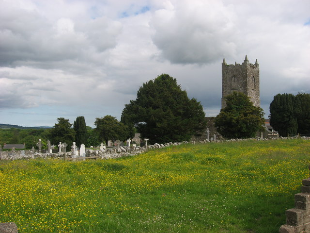
The late 19th century church (1888) of Garristown stands within a walled graveyard (DU003-011003-) on an elevated position in the village of Garristown. It occupies the site of the medieval parish church (DU003-011001-) (Lewis 1837 1, 650; Walsh 1888, 245). The parish church stood adjacent to the historic settlement or Manor of Garristown which was described in 1654-56 Civil Survey of Dublin as follows; 'There is upon ye premisses one ruined Castle [DU003-010----] one stone house Thatcht comonly called the Colledge of Garestowne one garden plott twenty three tenements valued by ye Jury at one hundred poundes one Mill [DU003-007----] valued (as afores[ai]d) at three poundes p[er] annum a few Ashtrees & ye Parish Church' [DU003-011001-] (Simington 1945, 17). In 1318, King Edward II granted to 'Humphrey Wace, the king's clerk, for good service for long time, of the keeping of the manor of Balliagary [Garristown] in Ireland, late of Drew de Merlet [Merlawe], tenant in chief, to hold until the full age of the heir' (Calendar of Fine Rolls, 348).
The settlement known as the Manor of Garristown which 'kept Court leet & Court Baron The Moyety of ye great tyth[e] belonged to the Lord Barnewall of Turvy the other Moyety thereof wth ye small tythes belonged to ye Vicar thereof wth a little stone house comonly called the Bartasse & another Tenement worth fourty shillings wth six acres of Arable land valued to be then worth one pound foure shillings' (ibid., 17). The 17th-century Down Survey map of Garristown parish shows a cluster of properties around the parish church site which may represent the remains of a clustered settlement at Garristown (NLI Ms. 714). A clustered settlement is depicted at Garristown on Rocque's 1760 Map of County Dublin.
NLI, Ms. 714 National Library of Ireland, The parish maps of the Down Survey for the County of Dublin by W. Petty (1657). Copied by Daniel O'Brien. A set of 42 maps with accompanying terriers, copied in 1786-7.
See attached section of Rocque's 1760 Map of County Dublin showing the 'Old Church' of Garristown
Compiled by: Caimin O'Brien
Date of upload: 6 March 2023
The monument record does not grant public access. Check the route and ask the landowner before entering private land.
- What survives
- Recorded monument
Places near here
 Grave YardGraveyard · 60 yd
 Architectural fragment in GarristownArchitectural fragment · 62 yd
 Garristown Churchchurch/chapel · 67 yd
 Church (in Ruins)Church · 71 yd
 Newtown GorseWood · 1.1 mi
 Newtown HillMountain / peak · 1.7 mi
 The story of the milk standMemorial · 2.3 mi
 PuddenhillHeritage attraction · 2.4 mi
 St. John's WellSpring · 2.6 mi
 FourknocksPassage tomb · 2.8 mi
 Lemur WoodWood · 3.6 mi
 Westown HouseCastle, tower house · 3.6 mi