What is recorded here
Marked only on the 1925 ed. of the OS 6-inch map, and situated on a level landscape. This is a granite stone with veins of quartz and a rectangular cross-section (dims. 1.4m NNE-SSW; 1m WNW-ESE; H 3m). A description of cupmarks (Kinahan 1883-4a 234-5; 1883-4c) and of an ogham inscription (Macalister 1949, vol. 1, 47-8) cannot be endorsed.
The above description is derived from the published 'Archaeological Inventory of County Wexford' (Dublin: Stationery Office, 1996). In certain instances the entries have been revised and updated in the light of recent research.
Compiled by: Michael Moore
Date of upload/revision: 16 August, 2013
Likely dating to the late Neolithic or Bronze Age, the Gallaun – Balloughton stone may have functioned as a boundary marker or ceremonial monument. Its placement on open ground suggests a possible role in territorial definition or ritual activity, though specific folklore or use remains unrecorded.
The monument record does not grant public access. Check the route and ask the landowner before entering private land.
- What survives
- Recorded monument
Places near here
 Saint Paul's Church (Kilcavan)church/chapel · 272 yd
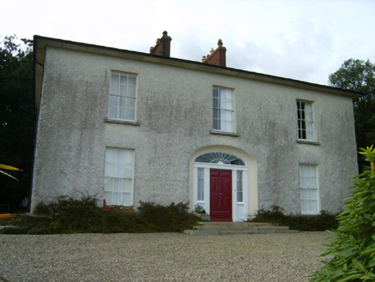 Balloughton Housefarm house · 731 yd
 Danes Castle (in ruins)Castle, tower house · 741 yd
 Font (present location) in DanescastleFont (present location) · 925 yd
 Enclosure in CoolishalEnclosure · 1102 yd
 Carrig-On-BannowVisitor information · 1153 yd
 1798 MemorialMemorial · 1212 yd
 CastleCastle, tower house · 1.1 mi
 Cullenstown StrandBeach / strand · 2.1 mi
 Ballymadder PointHeadland · 2.5 mi
 Blackhall StrandBeach / strand · 2.5 mi
 Bridges ChamberCave · 2.7 mi