
What is recorded here
On a gradual E-slope in poorly drained grassland in upland region with moated site (TS049-043----) 30m to N. Large, roughly circular monument (dims. 18m N-S; 18.5m E-W; max. H above ext. 0.7m) with a depression in the N quadrant (dims. 1.3m N-S; 1.2m E-W; max. D 0.35m), probably indicating the presence of a trough. Although there is no 'opening' in the fulacht fia, the mound is less prominent in the N quadrant where the N edge of the depression is 6.5m from the base of the mound.
Compiled by: Jean Farrelly
Date of upload: 26 August 2011
The monument record does not grant public access. Check the route and ask the landowner before entering private land.
- What survives
- Recorded monument
Places near here
 IndicatedFairy fort / earthen ringfort · 1105 yd
 Slieveardagh Househouse · 1.1 mi
 The Warhousehouse · 1.2 mi
 Warhouse HillMountain / peak · 1.2 mi
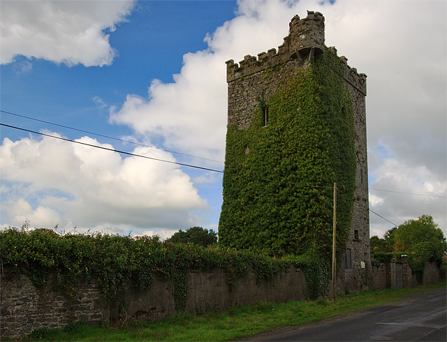 Site of Williamstown CastleCastle, unclassified · 1.2 mi
 Farranrory CastleCastle · 1.4 mi
 Site of ChurchChurch · 1.6 mi
 Top Field at Carey'sForest · 2.3 mi
 Second Field on the HillForest · 2.4 mi
 Bregaun HillMountain / peak · 2.5 mi
 Kilcooly AbbeyHeritage attraction · 4.4 mi
 Derrynaflan TrailHeritage attraction · 6.5 mi
Other information
Photo: Credit not shown in the picture search · Rights wording not checked; contact us if this picture should be removed