What is recorded here
On a generally level area, in improved rough pasture. The field surface is very uneven across this area due to rock outcrop. A system of low, sod-covered walls which are radiating from an enclosure (CL035-160----) at NW, NE, S and W, as identified by satellite imagery (https://binged.it/2mXvaZJ, accessed 6 March 2017). A number of linear field walls are in the vicinity of the enclosure and appear to be contemporary. They consist of some continuous stretches of wall (i.e. those to NE) and some intermittent, more piecemeal portions with gaps (i.e. those to S and NW). A potential portion extending from the enclosure at W could not be seen clearly on the ground, although a linear feature (long axis NE-SW) can be seen to correlate to a tract of rock outcrop. The wall at NW extends (L c. 16m) in a linear alignment (long-axis c. N-S). A short portion of wall (long axis c. NNW-SSE) at S extends (L 6.5m) before turning at an obtuse angle and continuing (long axis WNW-ESE) as a scarp (L c. 60m) in an ESE direction. The wall (Wth 1.95m; H 0.3-0.4m) at NE continues (long axis NE-SW) for a short distance (L c. 8m) from the enclosure before it forks to NNW and ESE. The wall (L c. 45m) to NNW is in a piecemeal condition and that to ESE has been reduced to a scarp (Wth 1.9m; H 0.2-0.3m). The latter appears to meander (L c. 92m) to ESE before extending (L c. 18m) to NE and then meandering (L c. 85m) to NW to enclose a larger area (80m NW-SE; c. 78m NE-SW). There are numerous other undulations in this vicinity particularly to W and N of the enclosure and further to ESE, some of which may be associated with the field system, whilst others are probably natural rock formations rising close to the surface.
The following images have been uploaded:
CL035-160001-_01.jpg From NW. Cross-sectional view of field wall at NE.
CL035-160001-_02.jpg From S. Cross-sectional view of field wall at S.
CL035-160001-_03.jpg From NW. Cross-sectional view of field wall to ESE.
Compiled by: Mary Tunney, Alison McQueen and Vera Rahilly
Date of upload: 10 July 2018
The monument record does not grant public access. Check the route and ask the landowner before entering private land.
- What survives
- Recorded monument
Places near here
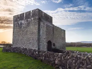 Enclosure in Cloonteen (tulla Upper By.)Enclosure · 44 yd
 Enclosure in LissofinEnclosure · 343 yd
 worker's houseworker's house · 558 yd
 Lissofin Castle (in ruins)Castle, unclassified · 635 yd
 Bunavory Castle (in ruins)Castle, unclassified · 1725 yd
 The StablesGallery · 1.0 mi
 Saint Mochulla's Church (Tulla)graveyard/cemetery · 1.0 mi
 Cloghleagh RockNamed rock · 1.9 mi
 The RingfortHeritage attraction · 3.2 mi
 Derrymore WoodWood · 4.9 mi
 HawthornHawthorn · 7.5 mi
 G.A.A. Commemorative StoneMemorial · 8.3 mi