What is recorded here
Fegart Point holds a 3.04m standing stone in tidal waters, locally believed to be a monument rather than a navigation mark. The sea claims and returns it twice daily, forcing whoever set it there to accept that memory itself must endure drowning. Its thin 0.18m frame suggests deliberate visibility from a boat, yet its size and placement resist ordinary measurement. Perhaps it marks a boundary between human certainty and marine change.
A standing stone 3.04m high × 1.06m wide × 0.18m thick. Situated in tidal waters off Fegart Point and is locally believed to be a monument and not a navigation mark.
The above description was derived from the 'Archaeological Survey of County Donegal. A description of the field antiquities of the County from the Mesolithic Period to the 17th century.' Compiled by: Brian Lacey with Eamon Cody, Claire Cotter, Judy Cuppage, Noel Dunne, Vincent Hurley, Celie O'Rahilly, Paul Walsh and Seán Ó Nualláin (Lifford: Donegal County Council, 1983). In certain instances the entries have been revised and updated.
Date of upload: 22 September 2008
Likely dating to the Neolithic or Early Bronze Age, Fegart standing stone may have functioned as a territorial marker, ceremonial monument, or astronomical alignment feature. Local belief suggests it is a prehistoric monument rather than a modern navigation aid, though its specific meaning or use remains unrecorded.
The monument record does not grant public access. Check the route and ask the landowner before entering private land.
- What survives
- Recorded monument
Places near here
 Magheranaul Wedge TombWedge tomb · 986 yd
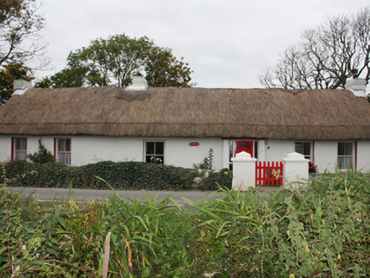 Rose Cottagehouse · 1534 yd
 Malin Presbyterian Meeting Housechurch/chapel · 1.3 mi
 Cross in Carrowreagh OR CraignacallyCross · 1.3 mi
 Dough Famine VillageHeritage attraction · 1.7 mi
 Doagh Famine VillageMuseum · 1.7 mi
 CastleCastle, unclassified · 1.9 mi
 Lag GraveyardGraveyard · 2.2 mi
 Five Finger StrandBeach / strand · 2.2 mi
 Bawn in CarrickabraghyBawn · 3.2 mi
 Carndonagh Early Church GraveyardGraveyard · 3.2 mi
 Glashedy IslandIslet · 4.2 mi