What is recorded here
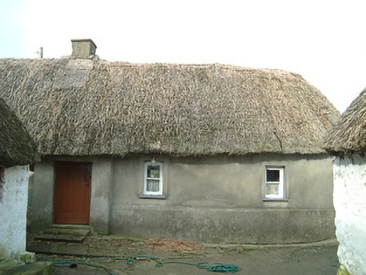
Farmyard complex, c.1800, including: (i) Detached four-bay single-storey thatched farmhouse with dormer attic with entrance windbreak, and three-bay single-storey rear (north-west) elevation. Hipped roof (continuing over windbreak) with water reed thatch having rope work to ridge, and rendered chimney stack. Unpainted rendered walls over random rubble stone construction possibly having sections of mud wall construction incorporating slight batter. Square-headed window openings with cut-stone sills, rendered surrounds, and one-over-one timber sash windows. Square-headed door opening with step, and timber boarded door. Set back from line of road in own grounds with rear (north-west) elevation fronting on to road. (ii) Detached three-bay single-storey thatched outbuilding perpendicular to south with square-headed carriageway to left, and two-bay single-storey rear (south-west) elevation. Pitched and hipped roof with water reed thatch having rope work to ridge. Painted (limewashed) random rubble stone walls. Square-headed door openings with timber lintels, and timber boarded doors. Square-headed carriageway to left with timber lintel, and no fittings. (iii) Detached two-bay single-storey thatched outbuilding perpendicular to south. Pitched and hipped roof with water reed thatch having rope work to ridge. Painted (limewashed) random rubble stone walls. Square-headed door openings with timber lintels, and timber boarded doors having one timber boarded half-door.
A collection of modest-scale ranges forming a neat self-contained farmyard complex comprising one of a number of sites producing a settlement or clachán (with 12404520 - 1/KK-45-20 - 1) representing an important element of the vernacular legacy of County Kilkenny as identified by attributes including the construction in locally-sourced materials, the windbreak, the thatched roof possibly originally incorporating a covering gleaned from the banks of the nearby River Suir, and so on. Having historically been well maintained each range retains the essential composition attributes together with substantial quantities of the historic fabric, thereby maintaining the character of the local landscape.
This does not grant access. Most recorded buildings are privately owned; view them only from public ground unless the owner allows entry.
Places near here
 water pumpwater pump · 47 yd
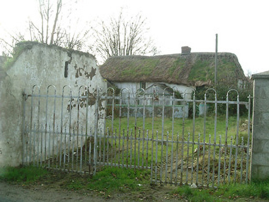 farm housefarm house · 152 yd
 Mount Congreve GardensHeritage attraction · 1014 yd
 Monterey CypressMonterey Cypress · 1164 yd
 Sargent's magnoliaSargent's magnolia · 1189 yd
 Viking settlement siteArchaeological place · 1309 yd
 Enclosure in Woodstown (middlethird By., Killoteran Par.)Enclosure · 1342 yd
 CastleCastle, unclassified · 1374 yd
 Corluddy Castle (in Ruins)Castle, tower house · 1.1 mi
 Waterford & Suir Valley RailwayHeritage attraction · 1.4 mi
 St. Martin's WellSpring · 6.8 mi
 St. Bernard's WellSpring · 7.7 mi
Other information
Photo: National Inventory of Architectural Heritage · Website use allowed for educational or private purposes with source credit