What is recorded here
Dún Dearg is a D-shaped stone ringfort on a high rocky knoll overlooking Streamstown Bay, where a grass-covered wall meets a natural rock ridge to enclose a small living space. Its tiny circular depression and two lost neighbouring cahers suggest a cluster of homes or markers rather than a single grand hall. The bay below and the sharp rock above created a place where people could watch the water, keep livestock, or simply believe the fairies had taken the best view.
On a high rocky knoll overlooking Streamstown Bay. Known locally as Dún Dearg, this is a poorly preserved D-shaped cashel (N-S 11m, E-W 10m) defined by a grass-covered drystone wall from W through N to E. A natural ridge of rock outcrop forms the enclosing element at S. To N of centre is a small circular stone-lined depression (D 1.2m). Two similar 'cahers' once lay to N (GA022-071----, GA022-071001-). (Petrie 1972, 253)
The above description is derived from the published 'Archaeological Inventory of County Galway Vol. I - West Galway'. Compiled by Paul Gosling (Dublin: Stationery Office, 1993).
Date of upload: 05 August 2010
The monument record does not grant public access. Check the route and ask the landowner before entering private land.
- What survives
- Recorded monument
Places near here
 Grave Yd.Graveyard · 308 yd
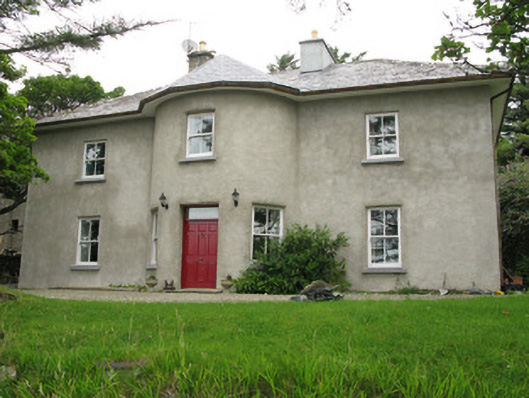 Streamstown Househouse · 514 yd
 Shaft of Copper MineMine · 1027 yd
 Letterdeen Standing StoneArchaeological place · 1095 yd
 Boolard IslandIslet · 1158 yd
 Bawn in Doon (ballynahinch By.)Bawn · 1.6 mi
 Abbeyglen Castle HotelCastle · 1.9 mi
 Sky RoadViewpoint · 2.0 mi
 Lavelle Art GalleryGallery · 2.0 mi
 Alcock and Brown Atlantic CrossingMemorial · 3.2 mi
 Hog IslandIslet · 3.5 mi
 Acton BeachBeach / strand · 3.5 mi