What is recorded here
Fairy fort / stone ringfort in Glenballythomas is a fairy fort or stone ringfort in Glenballythomas, County Roscommon, Ireland. A subcircular grass-covered area measures 45.3m E-W and 39m N-S inside a grass-covered earth and stone spread 3-5m wide and 0.2-0.5m high. Internal and external facing-stones remain, with original 2m width at the north, while a 1.6m stone-lined entrance opens at the southeast. Relict field banks surround the site, one north-south bank overlies the interior, and a man-made underground passage lies just outside the western perimeter.
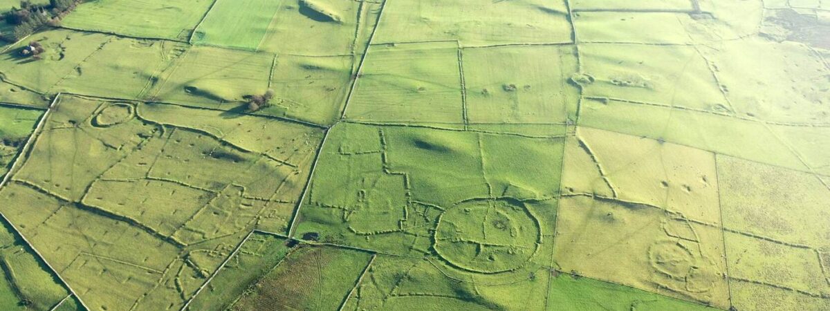
In a slight fold of the S-facing slope of Rathcroghan ridge. Subcircular grass-covered area (int. dims 45.3m E-W; 39m N-S) defined by a grass-covered earth and stone spread (Wth 3-5m; H 0.2-0.5m) with internal and external facing-stones (at N: original Wth 2m). The stone-lined entrance (Wth 1.6m) is at SE. The site is surrounded by the relict field banks of the field system (RO022-057003-), and one N-S field bank overlies the interior. Man-made underground passage (RO022-057040-) is just outside the perimeter at WSW, and the concentric enclosure (RO022-057035-) is c. 100m to the N. (Knox 1914a, 29-30, cashel No. 4; Herity 1983, Fig. 37, Glenballythomas 26; Waddell 1983, 31, No. 15)
This is a National Monument in state ownership: No. 473
See the attached aerial image taken from the E.
Compiled by: Michael Moore
Date of upload: 24 August 2010
The monument record does not grant public access. Check the route and ask the landowner before entering private land.
- What survives
- Recorded monument
Places near here
 RelignareeConcentric enclosure · 192 yd
 IndicatedFairy fort / earthen ringfort · 539 yd
 Ancient RoadRoad, road/trackway · 1.4 mi
 CastlerubyCastle, unclassified · 1.5 mi
 RoadRoad, road/trackway · 1.6 mi
 European ashEuropean ash · 1.7 mi
 ToberagullaSpring · 1.7 mi
 Cruachan Aí Heritage CentreMuseum · 2.4 mi
 GortnacushlaunCastle, unclassified · 4.2 mi
 War of Independence Commemorative Military MemorialMemorial · 4.8 mi
 Silver IslandIslet · 6.7 mi
 Workhouse MemorialMemorial · 7.3 mi