What is recorded here
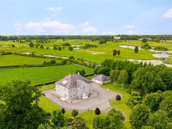
No visible trace of the fairy fort or its huge outer circle remains in Turnings Upper, though both appeared clearly on the 1838 map. A modern house and outbuildings now occupy part of the lost site, turning ancient boundary into domesticated ground. The disappearance does not diminish the place; it reminds us that mapping can preserve what memory and soil forget.
The monument is shown on the 1st ed. (1838) of the OS 6-inch map as circular area (est. max. diam. c. 70m) defined by a bank. (Also shown, as a dotted line, is a very large, outer enclosing feature (est. max. diam. c. 400m) concentric with the monument from E-N, which is of uncertain significance). On level, improved pasture. No visible surface trace of either feature survives, and a modern house with extensive outbuildings occupies part of the site.
Compiled by: Gearóid Conroy
Date of upload: 10 June 2011
The monument record does not grant public access. Check the route and ask the landowner before entering private land.
- What survives
- Recorded monument
Places near here
 Lady WellHoly well · 888 yd
 Baptismal FontFont · 896 yd
 Castle and ChurchChurch · 907 yd
 Ponsonby Bridgebridge · 1249 yd
 TumulusCastle, motte and bailey · 1.6 mi
 McCullagh's WoodWood · 1.8 mi
 Common LimeCommon Lime · 1.9 mi
 Oughterard Round TowerHeritage attraction · 2.0 mi
 Arthur Guinness GraveMemorial · 2.0 mi
 Oughterard CastleCastle · 2.0 mi
 The Steam MusemMuseum · 2.1 mi
 Battle of GlenmamaMajor battlefield · 2.1 mi