What is recorded here
On a natural rise, ground falling off to NW in undulating terrain, under pasture. Ringfort overgrown with nettles and thistles. Field boundary to N has been removed, boundary to S still in situ. Large sileage mound is located immediately W of ringfort and older, smaller heap to N. Roughly circular area (diam. 33.5m N-S; 30m E-W) defined by bank (Wth 1.2-1.8m crest, 3.1-3.7m base; H above int. 0.81-0.46m; H above ext. 0.06-0.55m in SE and SW quadrants respectively). Interior is very disturbed, appears to have been partially dug into and sileage dumped into interior, particularly in E half. On the 1st (1840) ed. OS 6-inch map a quarry is depicted adjoining the NW quadrant. Where the bank is disturbed it appears to have a high stone content. No fosse visible above ground or clearly defined entrance. Tractor marks on bank in W quadrant. Post and wire fence transects the N quadrant from E-W.
Compiled by: Jean Farrelly
Date of upload: 26 August 2011
A local fairy fort (ringfort/rath); wider significance not recorded.
This remains an important historical record, but the official description says the monument is no longer visible or has been destroyed. The monument record does not grant public access. Check the route and ask the landowner before entering private land.
- What survives
- No visible remains or recorded as destroyed
Places near here
 Ballylegan Church (in ruins)Church · 826 yd
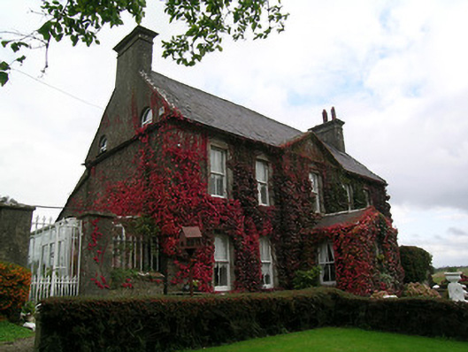 Keylong Househouse · 867 yd
 Kedrah FortArchaeological place · 1397 yd
 Short Castle (in ruins)Castle, tower house · 1.1 mi
 Bawn in CastlecoyneBawn · 1.1 mi
 Enclosure in EdenmoreEnclosure · 1.2 mi
 Caher AbbeyHeritage attraction · 1.8 mi
 Cahir CastleHeritage attraction · 1.9 miSiege of Cahir Castlesiege · 1.9 mi
 Pedunculate OakPedunculate Oak · 2.5 mi
 European YewEuropean Yew · 2.6 mi
 Woodcock HillMountain / peak · 4.2 mi