What is recorded here
Cultivation ridges still cross the oval earth at Shanavally, proving the fort served living people before becoming a fairy story. The double bank and central gap suggest a working farmstead where residents entered from the east and stored goods within the protected curve. Local legend may have replaced human memory, but the soil preserves the shape of hands that built and lived there.
In pasture, on NE-facing slope. Oval area (63m E-W; 54.7m N-S) enclosed by earthen bank (int. H 0.9m) to S, W and N; scarp to E; intervening fosse and second bank (H 0.55m) survives WSW->NNW. Bulge on inner face of inner bank to SW; gap to ENE. Gap in outer bank to WSW. Cultivation ridges cross interior on E-W axis.
The above description is derived from the published 'Archaeological Inventory of County Cork. Volume 2: East and South Cork' (Dublin: Stationery Office, 1994). In certain instances the entries have been revised and updated in the light of recent research.
Date of upload/revision: 14 January 2009
The monument record does not grant public access. Check the route and ask the landowner before entering private land.
- What survives
- Recorded monument
Places near here
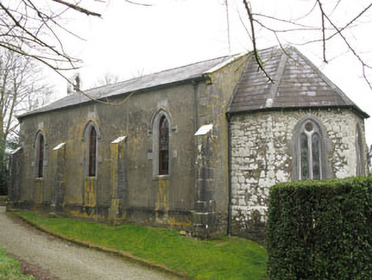 Ballymartle Churchchurch/chapel · 160 yd
 Church (in Ruins)Church · 185 yd
 Altar RockMass-rock · 1014 yd
 IndicatedFairy fort / earthen ringfort · 1020 yd
 Curra WoodForest · 1254 yd
 Sunday's WellSpring · 1546 yd
 Dinny Barry MemorialMemorial · 1.1 mi
 Dooneen WoodsWood · 1.3 mi
 St Laitiarain's WellSpring · 1.8 mi
 Cullen Castle (Site of)Castle, unclassified · 2.1 mi
 Meadstown Castle (Site of)Castle, unclassified · 3.7 mi
 The Stone of DestinyMemorial · 4.0 mi