What is recorded here
Rathlumber holds a broad circular fort with a low bank, shallow ditch and two flat stone platforms, one near the centre and one at the north-east edge. It sits in a damp, low place where water would have gathered around its rim, making the fort look like a small island in seasons of rain. People may have stood on those platforms to watch the land, store things or mark the boundary of a household, while the ditch kept ordinary traffic at a distance.
Circular enclosure (max. diam. c. 50m N-S) situated in low lying area and delimited by a small bank (c. 1m H) and by a shallow fosse (max. Wth. c. 3.5m) outside.
Small rectangular platform (67 x 5m) in NE quadrant and another (7m x12m) almost in centre of enclosure.
Circular enclosure (diam 47.5m) delimited by a small bank (H 0.5m) with shallow fosse (max. Wth 3.5m) with possible entrance gap (Wth 4m) at SE. Small rectangular platform (6m x 5m) in NE angle of site and another platform (7m x 12m) in the centre of the enclosure.
The above description is derived from the published 'Archaeological Inventory of County Offaly' (Dublin: Stationery Office, 1997). In certain instances the entries have been revised and updated in the light of recent research.
Date of upload: 23 May 2011
The monument record does not grant public access. Check the route and ask the landowner before entering private land.
- What survives
- Recorded monument
Places near here
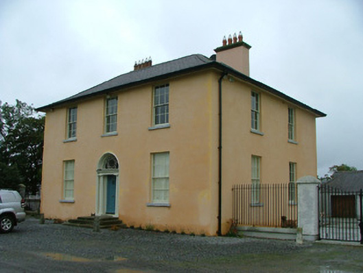 Ballymoran Househouse · 507 yd
 Field system in BallymoranField system · 1270 yd
 Enclosure in BallymoranEnclosure · 1385 yd
 Site of CastleCastle, unclassified · 1670 yd
 Church (in ruins)Church · 1.3 mi
 Ballybrittan CastleCastle, tower house · 2.5 mi
 Victoria PlantationWood · 3.4 mi
 Holy PlantationForest · 3.5 mi
 Allen family memorial headstoneMemorial · 4.0 mi
 Mountlucas Wind Farm Visitors CentreVisitor information · 4.0 mi
 Clonin EarthworksMountain / peak · 4.0 mi
 Sli na Slainte - mapVisitor information · 4.2 mi