What is recorded here
Half a circle of earth and shadow on a north-facing slope in Rathbranagh, the fort keeps its edge against the sky while livestock graze above it. It stands eighteen metres from a true ringfort, as if two households shared one ridge and one watched the other. The boundary line cuts through the east sector like a knife through a sentence, leaving the west half complete and the east half abandoned. People may have lived there, feared there, or simply passed around it with their hands full of milk and bread.
On a slight N-facing slope, in pasture, with moderate to good views in all directions and abutting the townland boundary with Maghera from N-E-SE. Ringfort (LI021-099----) lies 18m to N. Depicted on the 1840 ed. OS 6-inch map as a circular-shaped earthwork within a small subrectangular-shaped field. Monument surveyed by the ASI in 2000 and described as a roughly semicircular-shaped area (44m N-S; 23m E-W) defined by a scarp (H 0.6m) visible from SE-S-W-NW and cut by a townland boundary running N-S across the E sector. There is a break in the scarp from NW-N. The interior contains grass-covered piles of field clearance rocks and is very undulating. Monument is visible as a trapezoidal-shaped tree-lined earthwork on Digital Globe orthophotos taken 2011-13 and on Google Earth orthoimages taken 28/06/2018.
See attached sketch plan surveyed and drawn by ASI and Google Earth orthoimages.
Compiled by: Alison McQueen and Vera Rahilly
Date of upload: 29 July 2020
The monument record does not grant public access. Check the route and ask the landowner before entering private land.
- What survives
- Recorded monument
Places near here
 IndicatedEnclosure · 462 yd
 Enclosure in MagheraEnclosure · 533 yd
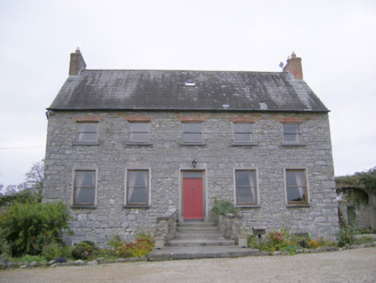 Tory Hill Housecountry house · 1425 yd
 Killeenoghty Church (in ruins)Church · 1571 yd
 Fanningstown Castle (in ruins)Castle, tower house · 1.3 mi
 Biodiversity in the Maigue CatchmentVisitor information · 1.5 mi
 Ballinveala Castle (in ruins)Castle, tower house · 1.7 mi
 European ashEuropean ash · 2.0 mi
 Dysert AenghusaHeritage attraction · 2.0 mi
 Monasteranenagh AbbeyHeritage attraction · 2.6 mi
 GinkgoGinkgo · 3.2 mi
 Villiers WellSpring · 3.7 mi