What is recorded here
You can still walk the ghost line of that buried ditch because the earth remembers the shape even when grass forgets it. A thirty-three metre circle, a tall bank, an eastern gap: small enough to know by heart, large enough to keep out what does not belong. People may have lived there, feared there or simply passed it with a nod. The fort does not need a name in a book when it stands there, rounding the field like a sentence repeated until it becomes true.
Raised circular area (int. diam. c. 33m) enclosed by a substantial earthen bank and an infilled fosse (Wth 3.2m) the outline of which is nonetheless distinguishable. An earlier report (OPW 1969) noted that the original entrance was at E.
The above description is derived from the published 'Archaeological Inventory of County Cavan' (Dublin: Stationery Office, 1995). In certain instances the entries have been revised and updated in the light of recent research.
Date of upload/revision: 22 December 2008
The monument record does not grant public access. Check the route and ask the landowner before entering private land.
- What survives
- Recorded monument
Places near here
 St Patrick's Roman Catholic Churchchurch/chapel · 352 yd
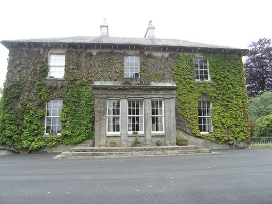 Tullyvin Housecountry house · 597 yd
 CorickMountain / peak · 671 yd
 Gallow's HillWood · 774 yd
 Gallows HillFairy fort / earthen ringfort · 785 yd
 Tullyvin WoodForest · 820 yd
 Drummury FortArchaeological place · 1064 yd
 Site of Old CastleCastle, unclassified · 1129 yd
 Bawn in DrumsheilBawn · 1.1 mi
 Brown's HillMountain / peak · 1.3 mi
 Giant's GraveArchaeological place · 2.7 mi
 Graveyard in Drumgoon (clankee By.)Graveyard · 3.7 mi