What is recorded here
Double-ramparted, thirty-eight metres across, with an inner bank twelve feet high and a possible hidden passage in the ditch, the fort stood on Leonard Leader's land until cattle wore it low and men levelled what remained around 1968. It is absent now except in map hachures and Bowman's measurements, yet the lost shape suggests a place sturdy enough to resist storms and ordinary time.
In level pasture. Depicted as hachured circular enclosure (diam. c. 38m) on 1842, 1904 and 1937 OS 6-inch maps; second bank hachured E->WSW on 1904 and 1937 OS 6-inch maps. No visible surface trace of site; according to local information inner bank and remaining portion of outer bank, which were low and heavily eroded by cattle, were levelled c. 1968. Recorded by Bowman (1934, 291) as double-ramparted fort on Leonard Leader's; about one-sixth of outer rampart levelled, remainder c. 7ft H; intervening fosse (Wth 18ft); inner rampart c. 12ft H from base of fosse. Possible Man-made underground passage (CO030-11602-) in intervening fosse.
The above description is derived from the published 'Archaeological Inventory of County Cork. Volume 4: North Cork' (Dublin: Stationery Office, 2000). In certain instances the entries have been revised and updated in the light of recent research.
Date of upload/revision: 14 January 2009
The monument record does not grant public access. Check the route and ask the landowner before entering private land.
- What survives
- Recorded monument
Places near here
 IndicatedKiln, lime · 1038 yd
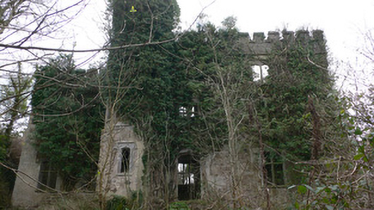 Duarrigle Castlecountry house · 1191 yd
 Fulacht Fiadh (Site of)Fulacht fia · 1193 yd
 Church (Site of)Church · 1.1 mi
 Dromsicane Castle (in Ruins)Bawn · 1.6 mi
 Castle and TurretCastle, tower house · 2.4 mi
 Millstreet Museum & Tourist Information CentreMuseum · 3.2 mi
 Millstreet Tourist InformationVisitor information · 3.2 mi
 Claragh Loop (Trailhead 99)Visitor information · 3.2 mi
 Claragh MountainMountain / peak · 3.8 mi
 RowanRowan · 4.0 mi
 Rathcool WoodWood · 4.5 mi