What is recorded here
No fairies are recorded there, only a broken earth bank on a western rise where people once lived, worked and left the hole open for the grass to swallow. The fort is small enough to walk inside a minute and old enough that its entrance has vanished, which means human memory failed before the story began. Lisnabrack keeps its shape through neglect, not praise.
Located on a rise on a W-facing with rock outcrop. This is a grass-covered subcircular area (int. dims 30m E-W; 26.5m N-S) defined by an overgrown earth and stone bank, best preserved at NE (Wth 3.3m; int. H 0.65m; ext. H 1.35m). The bank is reduced to a scarp (H 0.5m) at S, and there is a slight external fosse visible as a band of lush growth (Wth 3.1m) SE-S. The original entrance is not identified.
The above description is derived from 'The Archaeological Inventory of County Leitrim' compiled by Michael J. Moore (Dublin: Stationery Office, 2003). In certain instances the entries have been revised and updated in the light of recent research.
Date of upload: 23 September 2008
The monument record does not grant public access. Check the route and ask the landowner before entering private land.
- What survives
- Recorded monument
Places near here
 LisnabrackFairy fort / earthen ringfort · 739 yd
 Mass-rock in Lisnabrack (rosclogher By.)Mass-rock · 868 yd
 RC ChapelChurch · 1003 yd
 Kilroosk RockNamed rock · 1343 yd
 Ashisland WoodForest · 1.0 mi
 Longhill WoodForest · 1.3 mi
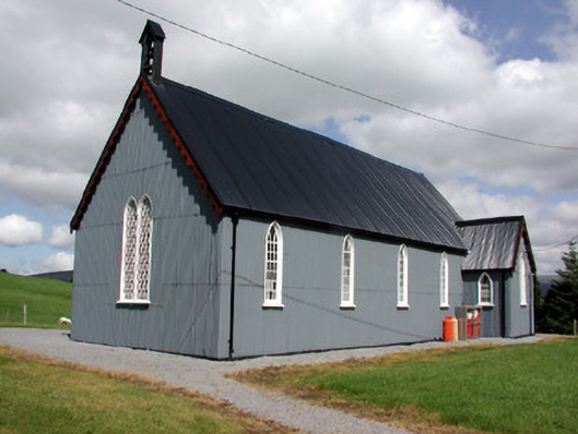 Lurganboy Church (Killasnet)church/chapel · 1.6 mi
 Castle CarCastle · 2.5 mi
 Giants RockNamed rock · 2.7 mi
 Saddle HillMountain / peak · 2.8 mi
 Agow TopMountain / peak · 3.0 mi
 The Giants GraveArchaeological place · 3.8 mi