What is recorded here
Fairy fort in Killeen, County Leitrim: a 29m earthen ring on a drumlin shelf, its eastern entrance now lost beneath farm sheds. The bank still stands where it can, a scarp and hedge elsewhere, with rushes ringing the outside like a forgotten rope. People may have lived inside, or never touched it at all; the shape suggests hands, but the story belongs to the field.
Located on a shelf on the N-facing slope of an E-W drumlin ridge and just N of a slight col between two knolls of that ridge. This is a grass-covered circular area (diam. 29m E-W; 25.7m N-S) defined by an earthen bank (Wth 2.5m; int. H 0.3-0.5m; ext. H 0.8-1m) NE-E which is reduced to a scarp (H 0.6-1m) elsewhere with a hedge on the perimeter, and an external band of rushes (Wth 1.5-2m). The entrance (Wth 4m) is at E. It has been removed since 2005 and is now occupied by farm sheds (Bing 2013).
The above description is derived from 'The Archaeological Inventory of County Leitrim' compiled by Michael J. Moore (Dublin: Stationery Office, 2003). In certain instances the entries have been revised and updated in the light of recent research.
Date of upload: 23 September 2008
This remains an important historical record, but the official description says the monument is no longer visible or has been destroyed. The monument record does not grant public access. Check the route and ask the landowner before entering private land.
- What survives
- No visible remains or recorded as destroyed
Places near here
 Enclosure in Tully (drumahaire By.)Enclosure · 766 yd
 No indicatedFairy fort / earthen ringfort · 937 yd
 St. Michaels ChurchChurch · 1085 yd
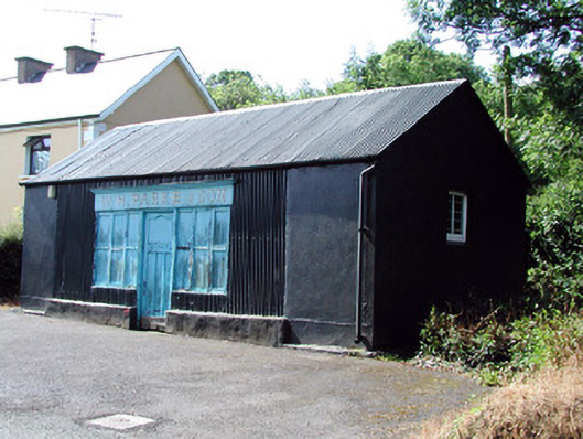 W.H. Parke and Sonshop/retail outlet · 1620 yd
 Old HallCastle, hall-house · 1.7 mi
 IndicatedBawn · 1.8 mi
 Green IslandIslet · 3.0 mi
 Cullentra ForestForest · 3.7 mi
 Trawane BayBay · 4.2 mi
 InnisfreeIslet · 4.3 mi
 Parke's CastleHeritage attraction · 4.6 mi
 SlishwoodWood · 4.7 mi