What is recorded here
Killaspuglonane holds a broken double ring where a road cut through ancient defences. Earth and stone still mark the inner circle beside the Dealagh River, but the outer wall has vanished into the swelling fields. The missing entrance and truncated banks suggest the fort was never abandoned, only redrawn by cartographers and forgotten by passersby.
On a slight rise in low-lying scrubby pasture c.70m NW of the Dealagh River, partially truncated by a road to the SW leading to the adjacent New Bridge. Hachured on the 1840 and 1916 OS 6-inch maps. A bivallate rath (int. diam. 23m E-W; 20m NNW-SSE) defined by an inner earthen bank (ext. H c. 0.95-1.85m) surmounted by a stone wall, a round-bottomed fosse (Wth 9m; ext. H 0.65-1m), and an outer bank (Wth 3-9m; ext. H 1-2m). The inner bank in overlain by a collapsed stone wall 2-3 courses high visible intermittently from the E to the SW (Wth 1.5-1.6m; H 0.15-0.2m). The SW part of the enclosing elements have been truncated by the adjacent road and the banks and fosse have been reduced to two scarps and a berm from N to ENE. No clear entrance is visible. The interior slopes gently down to the SE and is densely overgrown.
Compiled by: Mary Tunney and Eve Campbell
Date of upload: 14 August 2023
A bivallate earthen ringfort (rath) in Killaspuglonane, likely dating to the early medieval period, situated on a slight rise near the Dealagh River. It appears on 19th-century Ordnance Survey maps and is associated locally with fairy folklore, as suggested by its common name.
The monument record does not grant public access. Check the route and ask the landowner before entering private land.
- What survives
- Recorded monument
Places near here
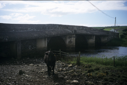 New Bridgebridge · 109 yd
 Enclosure in CaheraderryEnclosure · 751 yd
 Enclosure in KillaspuglonaneEnclosure · 808 yd
 Church in KillaspuglonaneChurch · 903 yd
 Dough CastleRuins · 1691 yd
 Kilmanahn GraveyardRuins · 1.1 mi
 Site of Tullamore CastleCastle, unclassified · 1.3 mi
 Famine MemorialMemorial · 1.4 mi
 Lahinch BeachBeach / strand · 1.6 mi
 John P. Holland CentreMuseum · 2.9 mi
 TullygarvanWood · 3.2 mi
 Bridget's Well;St Bridget's WellSpring · 3.8 mi