What is recorded here
Half a mile northeast of St. Gertrude's Church in Firies, an enormous earthen ringfort once rose above the pasture. Farmers flattened and ploughed it away decades ago, leaving no ridge for eyes to find. The forgotten interior became a burial ground, dragging the dead into soil that had already swallowed a fortress.
In level pasture. An extremely large rath, called 'Killahaan' fort, which was levelled and 'partly tilled' was recorded in the 1840s in the NE end of this townland (OSNB, Molahiffe, no. 1, 37). According to local information, this rath was in the field to the NE of St. Gertrude's Church, Firies, and was levelled many years ago. It is not visible at ground level. Its interior was used as a burial ground (KE048-114002-).
Compiled by: Elizabeth Byrne, Ursula Egan and Sheila Ronan, Archaeological Survey Unit, University College, Cork.
Date of upload: 31 January 2011
The monument record does not grant public access. Check the route and ask the landowner before entering private land.
- What survives
- Recorded monument
Places near here
 Enclosure in KillahaneEnclosure · 121 yd
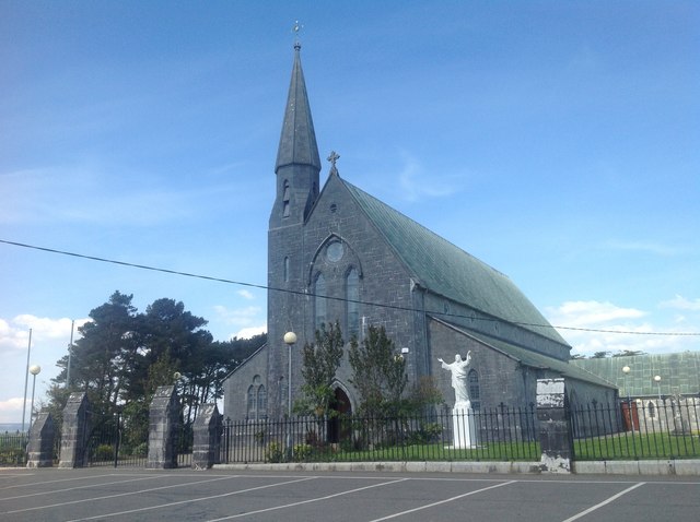 Saint Gertrude's Catholic Churchchurch/chapel · 144 yd
 Molahiffe Mill (Corn)Mill, unclassified · 435 yd
 Enclosure in BohereensEnclosure · 1080 yd
 CastleCastle, ringwork · 1133 yd
 Site of CourtCastle, unclassified · 1227 yd
 Ballygamboon Forest Recreation AreaWood · 4.2 mi
 The Kerry Creamery ExperienceHeritage attraction · 5.2 mi
 Scotia's GraveArchaeological place · 6.1 mi
 Aghadoe Early Medieval Ecclesiastical SiteHeritage attraction · 6.9 mi
 Japanese pagoda treeJapanese pagoda tree · 7.9 mi
 Famine MemorialMemorial · 8.0 mi