What is recorded here
Kilcondy’s fairy fort is a circular earthen ring about twenty metres wide, still standing in open pasture with a two-and-a-half-metre scarp and a shallow ditch at its southwest edge. It is the kind of place where ordinary farm life and old mystery mix: children may have called it a fairy fort, adults may have known it as a rath, and cattle may have walked past it for centuries without noticing how much older their pasture was. The ditch appeared on maps in 1904 and 1943, but the ring itself predates memory, holding its shape through rain, ploughing and forgetting.
In pasture. Circular raised area (diam. c. 20m) defined by scarp (H 2.5m); shallow external fosse to SW. Fosse depicted W->N on 1904 and 1943 OS 6-inch maps.
The above description is derived from the published 'Archaeological Inventory of County Cork. Volume 3: Mid Cork' (Dublin: Stationery Office, 1997). In certain instances the entries have been revised and updated in the light of recent research.
Date of upload/revision: 14 January 2009
The monument record does not grant public access. Check the route and ask the landowner before entering private land.
- What survives
- Recorded monument
Places near here
 Man-made underground passage in KilcondyMan-made underground passage · 180 yd
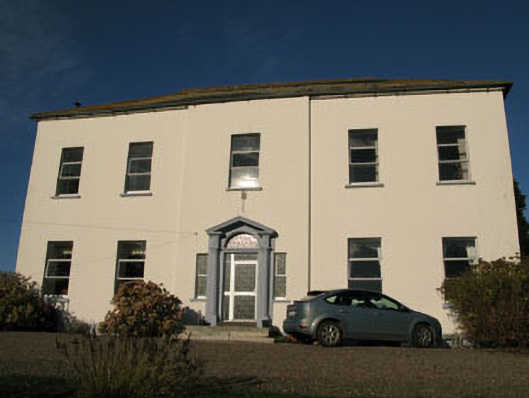 Crookstown Housecountry house · 489 yd
 Warrens Grove (in Ruins)Country house · 1058 yd
 Holy well in BallymichaelHoly well · 1259 yd
 Clodah CastleCastle · 1.0 mi
 Castlemore CastleCastle · 1.6 mi
 Independence MuseumMuseum · 1.7 mi
 Priest MemorialMemorial · 2.0 mi
 Andrew's WoodWood · 2.0 mi
 Kilmurry WoodsPicnic place · 2.1 mi
 Pedunculate OakPedunculate Oak · 2.2 mi
 Michael Collins MemorialMemorial · 2.8 mi