What is recorded here
One chambered hall, not a whole fort, stands behind a low earthen bank on a gentle east-facing slope in Dromdrasdil. Its narrow south-east gap, marked by a large boulder, leads into a dark underground passage in the southwest quadrant. The conifers growing inside and the boulders dumped along part of the bank suggest the place has been reused, hidden or changed since people first shaped it.
In pasture, on gentle E-facing slope. Roughly circular area (20m N-S; 24m E-W) enclosed by earthen bank (H 0.9m); shallow external fosse to W, N and E. Boulders dumped on bank to SSW; gap (Wth 1.4m) to SE, defined on W side by large boulder. Interior planted with conifers; raised slightly on N and E side to compensate for hillslope; Man-made underground passage (CO107-01002-) in SW quadrant.
The above description is derived from the published 'Archaeological Inventory of County Cork. Volume 1: West Cork' (Dublin: Stationery Office, 1992). In certain instances the entries have been revised and updated in the light of recent research.
Date of upload/revision: 14 January 2009
The monument record does not grant public access. Check the route and ask the landowner before entering private land.
- What survives
- Recorded monument
Places near here
 Man-made underground passage in DromdrasdilMan-made underground passage · 1 yd
 schoolschool · 655 yd
 Enclosure in DromdrasdilEnclosure · 689 yd
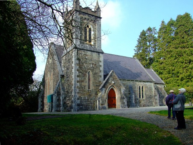 St. Edmund's Church of Ireland Churchchurch/chapel · 776 yd
 Togher CastleCastle, tower house · 1.8 mi
 Pookeen North TopMountain / peak · 2.2 mi
 Nowen HillMountain / peak · 2.7 mi
 Funmanway Adventure LandHeritage attraction · 3.1 mi
 Castle (Site of)Castle, Anglo-Norman masonry castle · 3.2 mi
 Dunmanway Heritage CentreVisitor information · 3.4 mi
 Graveyard in Dunmanway NorthGraveyard · 3.6 mi
 Mohona WoodWood · 4.1 mi