What is recorded here
Cush holds a broken ringfort beside the supposed cemetery of the Ernai tribe, where ordinary people may have lived beside beliefs that still shade the land. Ó Ríordáin cut through soil there in the 1930s and found house grooves, postholes and an abandoned underground passage, while a later house crossed the passage after it had silted. The fort is small, damaged and set inside older fieldworks, but its layers suggest a place where daily life continued long after its strangest part stopped being used.
In N corner of field in rough pasture, in N quadrant of an archaeological complex (LI048-034006/042-) located on the 'Supposed Site of Temaír Erann', which was the ancient cemetery of the Ernai tribe on Slievereagh (Sliabh Riabhach) (Westropp 1919, 9; Westropp 1917-19, 179; Westropp 1918, 111). Poorly preserved ringfort stands inside a large field system (LI048-034001-), with earthwork (LI048-034036-) immediately to SE and ringfort (LI048-034006-, Nat. Mon. No. 663) 20m to the E.
Listed as Ringfort No. 10 in the ‘Northern Group’ of forts excavated by Ó Ríordáin (1940, 128-132) between 1934-5, who described it as follows; ‘in the north-west corner of the northern field and portion of its defences were cut off by the modern field-fence on the west. The main defences of Ring-Fort 10 were the inner and middle banks and fosses. The inner bank had completely disappeared but the inner fosse could be found by excavation and on its inner side were found in one section (on the south-east) the remains of an external stone facing of the inner bank. The outer fosse was very slight and was, we have suggested, a later addition contemporary with the construction of the arc of Ring 9 [LI048-034036-]. Excavations of the ringfort (diam. c. 20m) revealed a Man-made underground passage (LI048-034034-) and house sites. The house sites were described by Ó Ríordáin (ibid. 131) as; ‘revealed, at a depth of 8 inches [0.2m] under the surface, a series of wall-grooves (charcoal- and humus-filled) which, to some extent, gave outlines of rectangular houses. Another groove, in outline a long arc of a circle, was situated on the eastern side of the end of a Man-made underground passage, for which it may have contained a protecting structure. The postholes A-G may represent some structure of similar purpose. There was indication that at least one of the houses represented by these bands of humified soil was in occupation after the Man-made underground passage had been deserted and had silted up, as one of the dark bands crossed the silted-over end of the Man-made underground passage.’ Outline of partially levelled ringfort (diam. c. 27m) transected at W by post-1700 field boundaries is visible on Digital Globe orthoimage taken between 2011-13 and on Google Earth orthoimages.
See attached plans from Ó Ríordáin and Google Earth orthoimages.
Compiled by: Fiona Rooney
Date of upload: 26 August 2021
A fairy fort or earthen ringfort in Cush is part of an early-medieval archaeological complex associated with the ancient cemetery of the Ernai tribe, likely dating to the 5th–10th centuries AD. Local tradition links the site to Temaír Erann, a historically significant location in early Irish tribal and ecclesiastical landscapes.
The monument record does not grant public access. Check the route and ask the landowner before entering private land.
- What survives
- Recorded monument
Places near here
 Hachured (1928), Temair Erann (Supposed Site of)Fairy fort / earthen ringfort · 69 yd
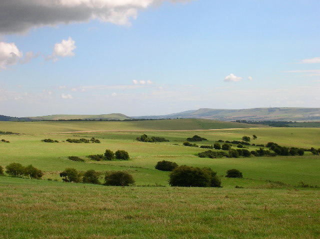 Field system in CushField system · 160 yd
 Quarry in CushQuarry · 193 yd
 Ballinvreena LoopVisitor information · 971 yd
 Bosnetstown Villahouse · 1296 yd
 SlievereaghMountain / peak · 1.7 mi
 Palatine's RockNamed rock · 1.8 mi
 Castle (in ruins)Castle, tower house · 1.9 mi
 Ballyhoura tourist informationVisitor information · 2.0 mi
 Ballyhoura WayWalking route · 2.0 mi
 Treada Na Ríogh (The Moat), hachuredCastle, motte · 2.1 mi
 Edmund's WellSpring · 2.1 mi