What is recorded here
Fairy fort in Corboy, County Longford: a 30-metre earthen ring in low pasture, lost first to a road and later to leveling. What remains is a faint trace in grass and memory.
In level, low-lying pasture. A report in 1975 (SMR file) recorded a raised circular area (diam. c. 30m) enclosed by a wide, low bank of earth and stone with a shallow external fosse. Most of the W half had been destroyed due to the construction of a modern NW-SE roadway. The original entrance was not recognisable. The rest of the rath has since been levelled but its outline may still be traced in a number of places, albeit with difficulty.
Compiled by: Patrick F. O'Donovan
Date of upload: 26 August 2011
The monument record does not grant public access. Check the route and ask the landowner before entering private land.
- What survives
- Recorded monument
Places near here
 CastleCastle, motte · 798 yd
 KilnKiln, lime · 970 yd
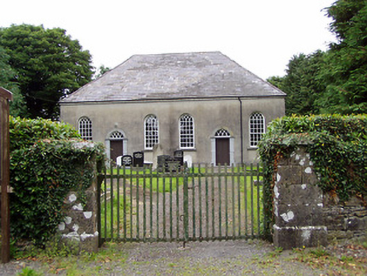 Corboy Presbyterian Churchchurch/chapel · 982 yd
 BarrowBarrow, unclassified · 1255 yd
 Enclosure in CloonahardEnclosure · 1.1 mi
 Bawn in LissardowlanBawn · 1.3 mi
 Oldtown DemesneForest · 1.7 mi
 Oldtown CopseWood · 1.8 mi
 Bully's Acregraveyard/cemetery, unknown · 4.2 mi
 Saint Mel's CathedralCathedral · 4.6 mi
 First World War MemorialMemorial · 4.7 mi
 National Famine WayWalking route · 5.3 mi