What is recorded here
Fairy fort / earthen ringfort in Cloonderry is a fairy fort or earthen ringfort in Cloonderry, County Sligo, Ireland. It occupies a slight rise in wet pasture and presents a roughly circular raised area measuring 24 metres north-south and 25 metres east-west. A narrow earth and stone bank encloses the centre, while a wider fosse and external bank surround the outside. A disused quarry cuts through the external bank at the northeast, and a four-metre break with a causeway marks the original entrance at the west-northwest.
Situated on a slight rise in gently undulating wet pasture. Raised roughly circular area (dims. 24m N-S; 25m E-W) enclosed by a narrow bank of earth and stone (Wth 5.1m; int. H 0.4m; ext. H 3.15m). At the external foot of the bank are a fosse (Wth 6.15m) and an external bank of earth and stone (Wth 6.95; int. H 1.2m). A roughly rectangular, now disused, quarry (dims. 12m NW-SE; 10m NE-SW; D 3m) abuts the external face of the inner bank and has been cut into the base of the fosse and through the external bank at NE. From E-WNW the external bank is absent but the outer edge of the fosse is still visible. A break (Wth 4m) in the internal bank with a causeway across the fosse at WNW marks the position of the original entrance. There is a modern break (Wth 5m) in the internal bank at WSW.
Compiled by: Patrick F. O'Donovan
Date of upload: 21 April 2011
The monument record does not grant public access. Check the route and ask the landowner before entering private land.
- What survives
- Recorded monument
Places near here
 Enclosure in CollinsfordEnclosure · 940 yd
 IndicatedFairy fort / earthen ringfort · 1101 yd
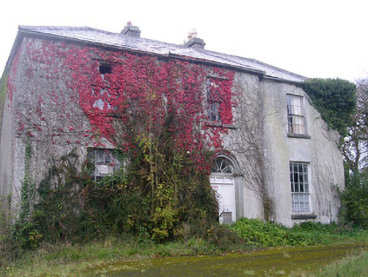 Doonally Househouse · 1.6 mi
 Kings MountainMountain / peak · 1.7 mi
 Saint Columba's Church (Drumcliff)church/chapel · 1.9 mi
 Drumcliff CemeteryGraveyard · 1.9 mi
 Grave of WB YeatsHeritage attraction · 1.9 mi
 Copes MountainMountain / peak · 2.2 mi
 Castle (in Ruins)Castle, unclassified · 2.3 mi
 Glencar Lough ViewpointViewpoint · 2.8 mi
 European BeechEuropean Beech · 2.8 mi
 Floods WoodForest · 3.3 mi