What is recorded here
Cathair Céirín is a ruined earthen ringfort in County Cork, Ireland. People called it a fairy fort because the broken bank and hidden cairn still suggest more than ordinary livestock pasture. The oval measure and narrow gap create a small chamber where human life may have turned, waited or disappeared into legend.
In pasture, on N-facing slope. Oval area (29.1m E-W; 24.4m N-S) enclosed by earth and stone bank (H 0.7m), topped by ruined stone field boundary. Break (Wth 1.5m) in bank to NW. Interior used for grazing; cairn (diam. c. 4m; H 0.9m), partially grass-covered, to E of centre.
The above description is derived from the published 'Archaeological Inventory of County Cork. Volume 3: Mid Cork' (Dublin: Stationery Office, 1997). In certain instances the entries have been revised and updated in the light of recent research.
Date of upload/revision: 14 January 2009
The monument record does not grant public access. Check the route and ask the landowner before entering private land.
- What survives
- Recorded monument
Places near here
 IndicatedHouse, indeterminate date · 386 yd
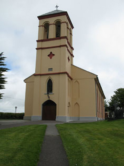 Séipéal Naomh Lachtáin [Saint Lachtáin's Catholic Church]church/chapel · 455 yd
 Toberlaghteen (covered)Holy well · 1102 yd
 Burial ground in Baile An BhuaidhBurial ground · 1441 yd
 Carrigaphooca CastleCastle · 2.1 mi
 Port Ban Nature Reserve, Irish Wildlife TrustNature reserve · 2.3 mi
 Dundareirke Castle (in Ruins)Castle, tower house · 2.5 mi
 Curraheen WoodWood · 2.6 mi
 European long distance path E8 - part IrelandWalking route · 4.0 mi
 Cnoc na nUlán (mullach thoir)Mountain / peak · 4.7 mi
 Macroom WalksVisitor information · 4.8 mi
 KnockullaneMountain / peak · 4.9 mi