What is recorded here
Carrig Demesne held a thirty-five metre earthen ring on a sunny slope above the Blackwater River, visible in old surveys and still marked by soil in the ploughed field. People farmed around it for generations, and local memory says the land was levelled in the 1950s, yet the ditch still shadows the crops when viewed from a distance. The fort has lost much of its shape but keeps its boundary, turning an ordinary field into a place where human hands and forgotten time still meet.
In tillage, on SSE-facing slope, overlooking Blackwater River to S. Depicted as hachured circular enclosure (diam. c. 35m) on 1842, 1905 and 1935 OS 6-inch maps; interior planted on 1842 OS 6-inch map. Slight rise visible in area of site; according to local information levelled c. 1950s. Circular enclosure visible as soilmark in ploughed field from high ground to S of Blackwater River. Fosse visible as cropmark in aerial photograph (CASAP).
The above description is derived from the published 'Archaeological Inventory of County Cork. Volume 4: North Cork' (Dublin: Stationery Office, 2000). In certain instances the entries have been revised and updated in the light of recent research.
Date of upload/revision: 14 January 2009
The monument record does not grant public access. Check the route and ask the landowner before entering private land.
- What survives
- Recorded monument
Places near here
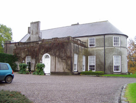 Rockforest Housecountry house · 1043 yd
 RockforestCountry house · 1063 yd
 Carrig Castle (in Ruins)Castle, tower house · 1312 yd
 Man-made underground passageMan-made underground passage · 1565 yd
 Grave YardGraveyard · 1718 yd
 Lover's LeapCliff · 2.1 mi
 Lover' LeapCliff · 2.2 mi
 Mallow Castle RuinRuins · 2.9 mi
 In loving memory of Elvis O'DonoghueMemorial · 3.6 mi
 Mallow River TrailVisitor information · 3.6 mi
 Blackwater WayWalking route · 4.0 mi
 Anne's Grove GardensHeritage attraction · 5.7 mi