What is recorded here
Fairy fort / earthen ringfort in Brittas (St. Patricksrock parish) is a fairy fort or earthen ringfort in Brittas (St. Patricksrock parish), County Tipperary, Ireland. It is a roughly D-shaped enclosure 26 metres north-south and 35 metres east-west, defined by an earthen bank 0.45 metres high inside and 0.87 metres high outside, with a high stone content and a 1.8-metre-wide, 0.2-metre-deep fosse that is deepest in the south quadrant and not visible above ground from the northwest through north to north-northeast. A 1.7-metre gap in the west quadrant faces the neighbouring possible ringfort and may be the original entrance, while a 3.1-metre gap near the northeast corner has a possible causeway over the fosse. The interior appears level, but the bank and interior are obscured by hummocks of grass, with scrub and brambles around the edge.
On a low E-W ridge in gently undulating grassland. A possible ringfort (TS060-063----) lies c. 15m to WNW and the Rock of Cashel (TS061-025003-) is clearly visible c. 1.5km to the ESE.A roughly D-shaped enclosure (diam. 26m N-S; 35m E-W) defined by an earthen bank (int. H 0.45m; ext. H 0.87m; Wth crest 1.7m; Wth base 5m) with a high stone content and a fosse (Wth 1.8m; D 0.2m) which is deepest in the S quadrant and is not visible above ground from the NW-N-NNE. It is depicted as being circular on the 1st (1840) ed. OS 6-inch map and as being roughly D-shaped on the 2nd (1906) edition. There is a gap (Wth 1.7m) in the W quadrant facing the neighbouring possible ringfort, which may be the original entrance. There is also a gap (Wth 3.1m) in the E quadrant, near the NE corner, which has a possible causeway over the fosse. The interior, which appears to be level, and the bank are obscured by hummocks of grass and there is scrub and brambles growing around the edge of the monument. There is a small area of quarrying in the fosse in the SW quadrant. A field boundary runs NNE-SSW past the SE quadrant and meets a field boundary running roughly E-W c. 13m S of the monument. The monument is fenced by a wooden fence with electric wire to the N and W.
Compiled by: Jean Farrelly
Date of upload: 26 August 2011
The monument record does not grant public access. Check the route and ask the landowner before entering private land.
- What survives
- Recorded monument
Places near here
 IndicatedEnclosure · 446 yd
 Enclosure in St. PatricksrockEnclosure · 1033 yd
 Hore AbbeyHeritage attraction · 1164 yd
 Kilbrista ChurchChurch · 1434 yd
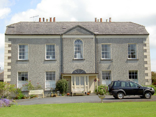 Rock Abbeyhouse · 1553 yd
 Rock of CashelHeritage attraction · 1583 yd
 The Rock Of CashelVisitor information · 1665 yd
 Black mulberryBlack mulberry · 1.0 mi
 Camus Castle (in ruins)Castle, unclassified · 1.4 mi
 Ballynahinch Castle (in ruins)Castle, tower house · 1.6 mi
 Ballyknock HillMountain / peak · 1.9 mi
 Dundrum Woods (Marl Bog)Forest · 6.6 mi