What is recorded here
Fairy fort / earthen ringfort in Ballyglass (rathconrath By.) is a fairy fort or earthen ringfort in Ballyglass (rathconrath By.), County Westmeath, Ireland. The 1970 description recorded an oval-shaped area measuring 35 metres north-south and 30 metres east-west, enclosed by a bank that was reduced to a scarp in places. This bank had an internal height of 0.6 metres and an external height of 1.2 metre, with an overall width of 4.2 metres.
Situated on the SW side, at the top of a hill, in pasture with good views in all directions. Ringforts (WM018-049----, WM018-046---- and WM018-047----) lie c. 100m to N, c. 150 to NW and c. 165m to W, respectively. Depicted on the 1837 ed. OS 6-inch map and the revised 1913 ed. OS 25-inch map as an oval-shaped earthwork.
Monument described in 1970 as an oval-shaped area (dims. 35m N-S; 30m E-W) enclosed by a bank which is reduced to a scarp in places. The bank (int. H 0.6m; ext. H 1.2m; Wth at top 1m; overall Wth 4.2m) is low in general and is slightly defaced at NNW. Two large upright slabs set radially in the bank at SE may define the original entrance although this is uncertain. These two stones are locally believed to mark the site of a 'King's Grave' (SMR File). There is no visible trace of a fosse. The interior has a SSW-facing slope with slight traces of cultivation ridges running NE-SW. Monument is visible as a partially tree-lined earthwork on Digital Globe aerial photography.
See attached sketch plan of monument surveyed and drawn by the ASI.
Compiled by: Alison McQueen, Vera Rahilly and Caimin O’Brien
Date of upload: 04 February 2019
A fairy fort or earthen ringfort in Ballyglass, likely dating to the early medieval period, is situated on a hilltop with extensive views, typical of defensive and strategic settlements of the time. It is associated with local folklore referring to "fairy" inhabitants and may have been considered a sacred or supernatural site in traditional belief.
This remains an important historical record, but the official description says the monument is no longer visible or has been destroyed. The monument record does not grant public access. Check the route and ask the landowner before entering private land.
- What survives
- No visible remains or recorded as destroyed
Places near here
 Partially hachuredFairy fort / earthen ringfort · 197 yd
 OutlinedHut site · 197 yd
 Ancient Ring FortWood · 525 yd
 Milltown Castle in ruinsCastle, unclassified · 921 yd
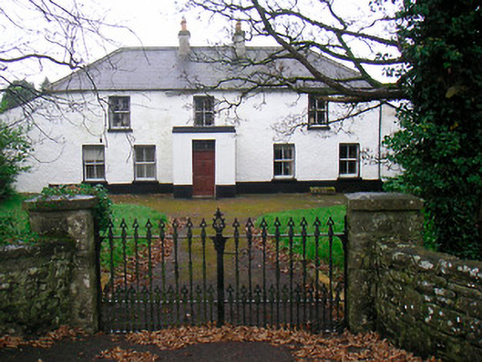 Ballyglass Househouse · 938 yd
 RathconrathCastle, motte · 1046 yd
 P. Gunninghouse · 1086 yd
 Hill of UisneachMountain / peak · 3.6 mi
 Baronstown ForestWood · 4.5 mi
 Abbeyshrule AbbeyRuins · 6.0 mi
 Guest ServicesVisitor information · 7.4 mi
 Goldsmith Birthplace, PallasVisitor information · 7.6 mi