What is recorded here
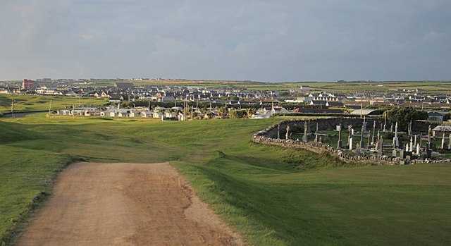
Knockmoylemore still holds a twenty-metre earthen chamber above Trabeg, preserving an L-shaped stone tunnel, uncertain internal banks and a ruined rectangular room that local memory calls a forge. The south-facing slope presents a inhabited threshold rather than a dead ruin, because people shaped, entered, remembered and changed the site across generations. Its damaged passage and missing wall do not subtract from the place; they reveal that human life continued to breathe through stone, soil and story.
Internal diam. 22m
Lisnacarheen/Lios na Ceártan: Situated on the lowermost, S facing slopes of Knockmoylemore, overlooking Trabeg. The site consists of a circular univallate rath containing a Man-made underground passage, possible hut-sites and a substantial rectangular house which is probably secondary. The earthen bank is c. 5m wide and 1m high, but has been removed entirely along the SE side.
There are several low banks of earth and stone in the interior, extending from the bank towards the centre, but their function is not clear. The drystone facing along the inner edge of the bank at NE may mark the location of hut-sites. The rectangular building measures 3.5m x at least 7m internally and is of drystone construction. The walls are 1m thick and a maximum of 1.2m high; the SE wall was recently destroyed. This is locally reputed to have been a forge.
The Man-made underground passage (KE043-200001-) has been extensively damaged. The present remains consist of an L-shaped passage which opens off the E side of a large excavation. The passage leads E for 1.3m then N for a further 5.3m. It is .46 to 1.3m wide and c 1.m high. The walls are constructed of upright slabs, c. 0.7m high, overlain by drystone walling, and the roof is closed by 8 flat slabs. The roof slab spanning the entrance to the longer passage is set .14m below the level of the remainder. An air-vent opens off the NE corner of the structure, about .75m above the floor. Traces of a 3rd passage are preserved in the recent excavation. It appears to have been aligned N-S, at right angles to the short section of the L-shaped passage. It was of drystone construction and was .65m wide, but its length is not known. Apparently the Man-made underground passage terminated with 'a small building with a fireplace in it' (OSNB Garfinny, 26), but this feature is not now evident.
The above description is derived from J. Cuppage, ‘Corca Dhuibhne. Dingle Peninsula archaeological survey. Ballyferriter. Oidhreacht Chorca Dhuibhne’ (1986), no. 344. In certain instances the entries have been revised and updated in the light of recent research.
Date of upload: 6 August 2013
This remains an important historical record, but the official description says the monument is no longer visible or has been destroyed. The monument record does not grant public access. Check the route and ask the landowner before entering private land.
- What survives
- No visible remains or recorded as destroyed
Places near here
 Lios CoilleArchaeological place · 342 yd
 Fulacht fia in Baile An Bhúlaeraigh TheasFulacht fia · 631 yd
 Church in Lios DeargáinChurch · 1229 yd
 An Cnoc Maol MórMountain / peak · 1.2 mi
 An ChorrMountain / peak · 1.3 mi
 An ChonairViewpoint · 1.7 mi
 Church in Páirc An TeampaillChurch · 1.9 mi
 Maughanablagher CliffsCliff · 1.9 mi
 Lispole Ambush MonumentWayside cross · 2.3 mi
 Ballintaggart Ogham StonesVisitor information · 2.5 mi
 CarrignawaddraNamed rock · 2.6 mi
 Castle (Site of)Castle, tower house · 2.7 mi