What is recorded here
Badger claws have scrambled the inner bank of An Paideac, but the underground passage still cuts a sharp shadow through the earth. That hidden chamber may have served as a cellar, a refuge or a temple, yet the fort stands guard over the entrance to Ventry Harbour like a forgotten door. Its exact purpose has slipped away, leaving behind a circular void that dares imagination to complete the missing shape.
Internal diam. 22.7m N-S, 24.3m E-W
This well-preserved, roughly circular rath with Man-made underground passage lies on a gentle W facing slope, on the headland that marks the E side of the entrance to Ventry Harbour. It is enclosed by an earthen bank and fosse but a 2nd outer bank, present along the N and W sectors only, appears to be a later feature, possibly part of the field boundary system. Field walls radiate out from the enclosure at SE and SW, the latter extending across the fosse to meet the bank. The outer bank is 1.1m high externally, 1.6m high above the base of the fosse, and is very regular in appearance. The fosse is up to 1m deep below the external ground level and c. 4m wide. The inner bank is a maximum of 3.5m high externally and 1.3m high internally and has been disturbed in places by badger sets. A 7.5m wide gap at E marks the site of the original entrance. The N side of this gap is occupied by a rectangular foundation which projects into the interior of the fort. The structure measures 4.4m N-S x 3.6m E-W internally and is enclosed partly by a stone wall and partly by a low bank. The ill-defined breaks in the ringfort bank at W and NE are secondary features.
The Man-made underground passage lies in the NW part of the interior, but the passage and chamber are now only marked by depressions in the ground. The depression or trench that marks the passage is up to 1.25m deep and 3.15m wide. It runs NE for 5.5m then curves around to run SE for 5.3m before meeting the chamber. The latter is represented by a circular depression, 4.1m in diameter and c. 0.6m deep. Part of the drystone-built walling of the structure survives for a short distance on the NE side of the passage where it meets the chamber. A small aperture in the side of the SW end of the passage may lead to a further section of the Man-made underground passage.
The above description is derived from J. Cuppage, ‘Corca Dhuibhne. Dingle Peninsula archaeological survey. Ballyferriter. Oidhreacht Chorca Dhuibhne’ (1986), no. 516. In certain instances the entries have been revised and updated in the light of recent research.
Date of upload: 7 August 2013
The monument record does not grant public access. Check the route and ask the landowner before entering private land.
- What survives
- Recorded monument
Places near here
 Man-made underground passage in An PaideacMan-made underground passage · 12 yd
 TobermichaelHoly well · 940 yd
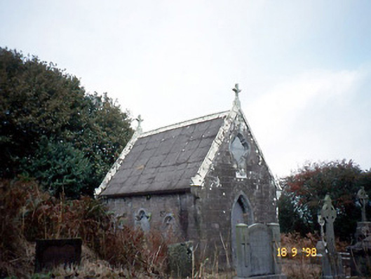 Reilig Ráithín Uí Bhuaigh [Reheenyhooig Graveyard]mausoleum · 1239 yd
 Coláiste Ídecountry house · 1713 yd
 Site of Ballingolin CastleArchaeological place · 1.0 mi
 CastleCastle, unclassified · 1.0 mi
 Cnoc na CeathrúnMountain / peak · 1.6 mi
 Trá Ciarán BeachBeach / strand · 1.8 mi
 An Chathair AirdMountain / peak · 2.1 mi
 Memorial to all who lost their lives in our seas.Memorial · 2.3 mi
 Dingle Marina Dive CentreHeritage attraction · 2.3 mi
 Charles HaugheyMemorial · 2.5 mi