
What is recorded here
Templemichael is a levelled circular enclosure, about forty metres across, on a south-facing pasture slope in County Cork. It still rises one metre above the grass, with faint banks running southeast and southwest into the field fence. The shape is small enough to walk around in a minute, yet it has kept its boundary through centuries of farming, weather and forgetting.
In pasture, on S-facing slope. Shown as hachured circular enclosure (diam. c. 40m) surrounding church (CO063-028002-) on 1842 OS 6-inch map. Levelled; low circular rise visible (max. H 1.1m). To SE and SW, low remains of banks run from the enclosure S into field fence.
The above description is derived from the published 'Archaeological Inventory of County Cork. Volume 2: East and South Cork' (Dublin: Stationery Office, 1994). In certain instances the entries have been revised and updated in the light of recent research.
Date of upload/revision: 14 January 2009
The monument record does not grant public access. Check the route and ask the landowner before entering private land.
- What survives
- Recorded monument
Places near here
 Templemichael Bridgebridge · 870 yd
 Fulacht fia in Knockboy (barrymore By.)Fulacht fia · 1318 yd
 Coole Mill (Woollen)Mill, woollen · 1432 yd
 Grave YardGraveyard · 1647 yd
 Castle (Site of)Castle, unclassified · 1.5 mi
 Castle (in Ruins)Castle, tower house · 1.6 mi
 Old Cemetery KilcullyMemorial · 3.3 mi
 Glanmire Heritage SocietyMemorial · 3.4 mi
 Murphy's RockViewpoint · 3.6 mi
 Cork WalksVisitor information · 4.3 mi
 Carberrytown WoodWood · 4.7 mi
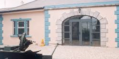 Collins Barracks Military MuseumMuseum · 5.1 mi
Other information
Photo: Credit not shown in the picture search · Rights wording not checked; contact us if this picture should be removed