
What is recorded here
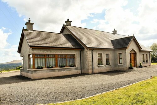
On relatively flat terrain, sloping generally to the SSW. There is no visible trace of the enclosure above ground. It is marked as a sub-rectangular area on the 1st (1840) OS 6-inch map, with the road forming the N boundary and a field boundary forming the W side. By the 2nd 1904-5 ed. the enclosure is not indicated. The area is now a small paddock with wooden fencing, adjacent to a new bungalow built immediately E of the enclosure.
Compiled by: Jean Farrelly
Date of upload: 03 February 2014
This remains an important historical record, but the official description says the monument is no longer visible or has been destroyed. The monument record does not grant public access. Check the route and ask the landowner before entering private land.
- What survives
- No visible remains or recorded as destroyed
Places near here
 IndicatedEnclosure · 272 yd
 Lisnamuck (Site of)Enclosure · 643 yd
 Nicholastown Castle (in ruins)Castle, tower house · 1536 yd
 Church in KilmalogeChurch · 1742 yd
 Derrygrath Church (in ruins)Church · 1.1 mi
 Coolbane Castle (in ruins)Castle, tower house · 1.2 mi
 DeerparkWood · 2.6 mi
 Woodcock HillMountain / peak · 2.8 mi
 Deodar CedarDeodar Cedar · 3.0 mi
 Cahir CastleHeritage attraction · 3.6 miSiege of Cahir Castlesiege · 3.7 mi
 Caher AbbeyHeritage attraction · 3.8 mi
Other information
Photo: Credit not shown in the picture search · Rights wording not checked; contact us if this picture should be removed