What is recorded here
On a hillock in low-lying grassland. Marked on OS 6-inch maps as a tree-planted enclosure. What survives is a poorly preserved subcircular enclosure (E-W 43.5m, N-S 40.5m) defined by a modern drystone wall. However, this appears to overlie an earlier wall, the presence of which is indicated by a spread of stone from SW to N. The footings of the original wall (Wth 1.6m) are visible at W. The interior is still planted with trees.
The above description is derived from the published 'Archaeological Inventory of County Galway Vol. II - North Galway'. Compiled by Olive Alcock, Kathy de hÓra and Paul Gosling (Dublin: Stationery Office, 1999).
Date of upload: 05 August 2010
The monument record does not grant public access. Check the route and ask the landowner before entering private land.
- What survives
- Recorded monument
Places near here
 MonumentLeacht cuimhne · 1148 yd
 Castlemoyle Ho.House, 18th/19th century · 1657 yd
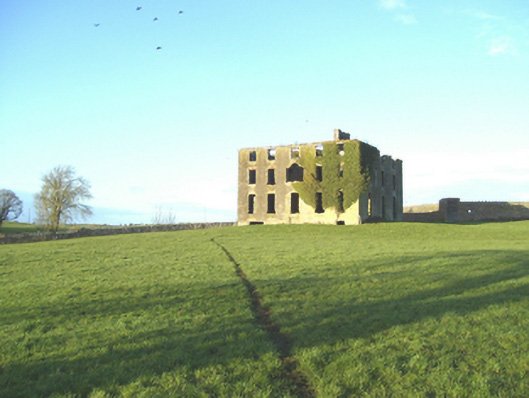 Castlemoyle Housecountry house · 1657 yd
 Man-made underground passage in Cartron (carrowrevagh Ed )Man-made underground passage · 1.5 mi
 Castle (in ruins)Castle, tower house · 1.6 mi
 Barnaderg CastleCastle · 2.8 mi
 European ashEuropean ash · 5.4 mi
 Knockmoy AbbeyHeritage attraction · 5.5 mi
 Mass RockNamed rock · 7.0 mi
 KnockmaaWood · 8.6 mi
 Menlough IRAMemorial · 10 mi
 Aghloragh Church (in ruins)Church · 1.1 mi