What is recorded here
Possible ecclesiastical enclosure identified by Swan (1988, 12) who recorded that there was evidence of a possible enclosure in the polygonal form of the graveyard (WM009-043001-) boundary of the graveyard (WM009-043001-) with curving boundary ditch to SW and S. Church ruins (WM009-043----) located in S quadrant of graveyard which forms the highest part of the burial ground. In 1940 Oliver Davies noted that the present graveyard may enclose an earlier burial ground or churchyard when he stated that the oldest and highest part of the graveyard is apparently circular (ITA Survey). This circular form may preserved the line of an ecclesiastical enclosure of Early Christian date. Traces of an enclosing fosse and external bank best visible from W to N may be remains of this earlier ecclesiastical enclosure.
Compiled by: Caimin O’Brien
Date of upload: 20 August 2015
The monument record does not grant public access. Check the route and ask the landowner before entering private land.
- What survives
- Recorded monument
Places near here
 Church (in ruins)Church · 36 yd
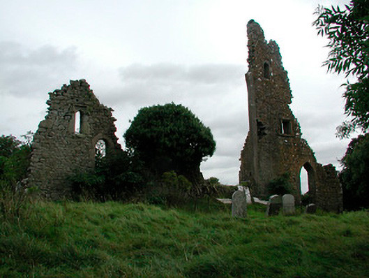 church/chapelchurch/chapel · 36 yd
 OutlinedFairy fort / earthen ringfort · 1106 yd
 Moneen WoodWood · 1554 yd
 Beggarbush WoodWood · 1.0 mi
 Drewstown LittleMountain / peak · 1.2 mi
 Dervotstown CastleCastle · 1.7 mi
 Bawn in Heathstown (delvin By.)Bawn · 1.9 mi
 Enclosure in Heathstown (delvin By.)Enclosure · 2.1 mi
 CloncatMountain / peak · 2.5 mi
 Causey FarmHeritage attraction · 2.8 mi
 FarmaphobiaHeritage attraction · 2.8 mi