
What is recorded here
On a gentle E-facing pasture slope. A sub-rectangular area (ext. dims. L 47.9m E-W; Wth 34.3m N-S) is defined by a broad, flat-topped earthen bank (Wth 1.7-3.1m; int. H 0.2m at S-1.1m at E and W; ext. H 0.9-1.3m) faced externally by a modern, mortared stone wall, with entrance gate at NE (Wth 2.6m). An internal path (Wth 2.2-2.8m) skirts the bank and may overlie an older fosse-line and encloses a slightly raised circular, central area (diam. 18-20m) which is defined by a scarp (H 0.5-1.4m). The interior contains a church (KD003-002002-) and a graveyard (KD003-002003-) and the perimeter carries mature chestnut and ash trees. A bullaun stone (KD003-002004-) was noted c. 50m to the NE of the monument in 1985 (SMR file). Visible as being overgrown with trees in a recent aerial photograph (OSi Orthophoto 2005).
Compiled by: Gearóid Conroy
Date of upload: 10 June 2011
A local fairy fort (ringfort/rath); wider significance not recorded.
The monument record does not grant public access. Check the route and ask the landowner before entering private land.
- What survives
- Recorded monument
Places near here
 Site of ChapelChurch · 15 yd
 Saint Brigid's Catholic Churchchurch/chapel · 1087 yd
 Site of Kilrathmurry GraveyardFairy fort / ringfort · 1488 yd
 CastleCastle, unclassified · 1656 yd
 Site of Balrinnet CastleCastle, unclassified · 1693 yd
 Bog WoodsWood · 1.2 mi
 Buggan's WoodWood · 1.4 mi
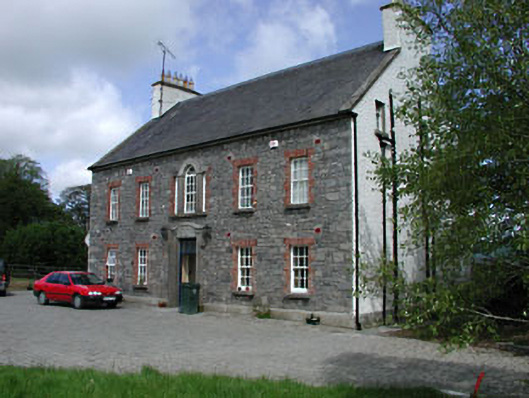 Kilglass Househouse · 1.6 mi
 Croppies' GraveMemorial · 2.3 mi
 The Fairy BowerHeritage attraction · 9.6 mi
 Lullymore Heritage ParkHeritage attraction · 9.6 mi
 Grand Canal WayVisitor information · 12 mi
Other information
Photo: Credit not shown in the picture search · Rights wording not checked; contact us if this picture should be removed