What is recorded here
On a west-facing slope above Lough Ree, two low banks of earth and stone still mark a vast ecclesiastical enclosure spanning nearly two hundred metres. They frame a late-medieval church and graveyard in Glebe, while a straight field boundary cuts the space between Rathcline and Glebe. The banks have been widened, lowered or absorbed into pasture, yet their outline remains visible in the grass. The place suggests a community that shaped the hillside before forgetting the names of its makers.
In pasture on a W-facing slope overlooking Lough Ree. This large enclosure (c. 175m WNW-ESE; c. 140m NNE-SSW) is defined by two low, widely spaced banks of earth and stone. The inner bank (Wth 5.5m; H 0.5m) survives from W-WNW-NW. It has been modified and incorporated into a field boundary at WSW. The distance between this bank and the outer bank is c. 12m. The latter bank, which has also been modified and incorporated into a field boundary, is similar in morphology to the inner bank and it survives from WSW-W-NW. Elsewhere both banks have been levelled but their outlines are identifiable. The enclosure is divided into unequal portions by a NNW-SSW field boundary that marks the boundary between Glebe and Rathcline townlands. Centrally located within it, in Glebe, is a late-medieval church (LF017-013001-) and graveyard (LF017-013004-). (ITA Survey 1944; Cahill 1984, 184-5)
Compiled by: Patrick F. O'Donovan, Caimin O'Brien
Date of upload: 4 June 2013
The monument record does not grant public access. Check the route and ask the landowner before entering private land.
- What survives
- Recorded monument
Places near here
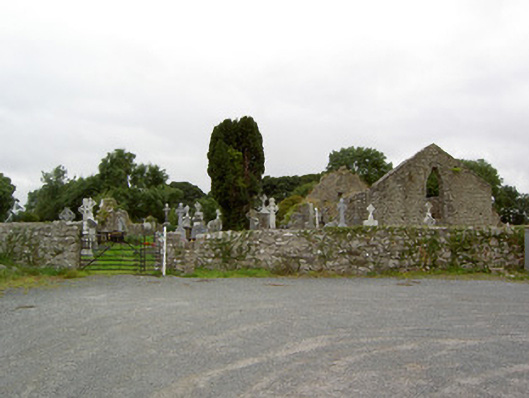 church/chapelchurch/chapel · 1 yd
 Cross in Glebe (rathcline By., Rathcline Ed)Cross · 16 yd
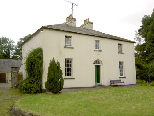 Rathcline Glebe Houserectory/glebe/vicarage/curate's house · 365 yd
 IndicatedEnclosure · 546 yd
 Rathcline CastleBawn · 897 yd
 White Sand WoodWood · 1717 yd
 Goat's IslandIslet · 1.3 mi
 Ballyclare IslandIslet · 1.3 mi
 Wild birdsVisitor information · 1.5 mi
 Commons North WalkVisitor information · 1.8 mi
 Caltragh CastleCastle, unclassified · 4.0 mi
 Cruit BayBay · 4.2 mi