
What is recorded here
A circular area defined by a low bank (W. c. 2.8m, Int. H. c. 0.5m, Ext. H. c. 0.5m) from NNW-E. Elsewhere it is indicated by a slight rise in the ground level. No evidence of fosse.
Described by Carrigan as 'The church (LA029-005001-) of Dairy Hill has entirely disappeared. The churchyard (LA029-005002-) of Dairy Hill is about an Irish acre in area, and is enclosed by a great earthen fence. It is now all overgrown with bushes. The graveyard was last used for the interment of an adult about 1820; it is now only used as a burial place for unbpatized children' (Carrigan 1905, vol. 2, 56-7).
The above description is derived from the published 'Archaeological Inventory of County Laois' (Dublin Stationery Office, 1995) compiled by P. David Sweetman, Olive Alcock and Bernie Moran. In certain instances the entries have been revised and updated in the light of recent research.
Date of upload: 17 December 2007
A local fairy fort (ringfort/rath); wider significance not recorded.
The monument record does not grant public access. Check the route and ask the landowner before entering private land.
- What survives
- Recorded monument
Places near here
 Kyle-cruttiaChurch · 36 yd
 Burial Gd. (Disused)Church · 999 yd
 Enclosure in DairyhillEnclosure · 1016 yd
 Ballygeehin Castle (in Ruins)Bawn · 1284 yd
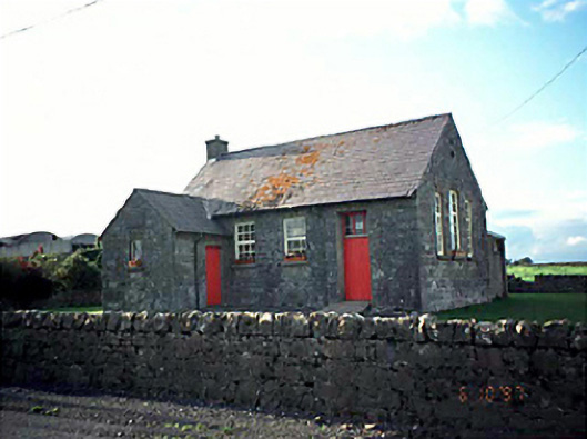 Ballacolla National Schoolschool · 1.1 mi
 European PearEuropean Pear · 1.2 mi
 Scotch RathHouse, fortified house · 1.9 mi
 Birchfield PlantationForest · 3.0 mi
 Knocknamoe HouseMemorial · 5.0 mi
 Abbeyleix Heritage CentreMuseum · 5.1 mi
 Anker's IslandIsland · 7.2 mi
 Cnoc SeanrathaMemorial · 8.5 mi
Other information
Photo: Credit not shown in the picture search · Rights wording not checked; contact us if this picture should be removed