What is recorded here
On a short but steep-sided NE-SW running glacial ride (L c. 250m), on N outskirts of Castleblakney village. From SW end of the ridge, where OS 6-inch map shows the site of a castle (GA060-081001-), a narrow trackway (Wth 8m) runs along its summit towards the lower NE end. This trackway is flanked on either side by a series of terraces (Wth 3.4-4m), supplemented along W side by a linear bank and fosse. Two wide fosses, running NW-SE, traverse the ridge, one at SW end delimiting the castle site, and another shallower example towards NE end.
The above description is derived from the published 'Archaeological Inventory of County Galway Vol. II - North Galway'. Compiled by Olive Alcock, Kathy de hÓra and Paul Gosling (Dublin: Stationery Office, 1999).
Date of upload: 05 August 2010
The monument record does not grant public access. Check the route and ask the landowner before entering private land.
- What survives
- Recorded monument
Places near here
 Castle (Site of)Castle, unclassified · 76 yd
 Enclosure in CastleblakeneyEnclosure · 546 yd
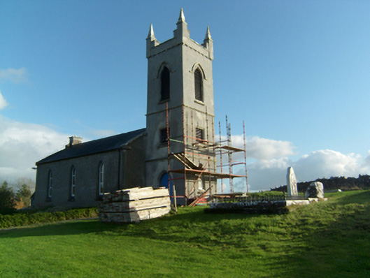 Saint Paul's Church (Killosolan)church/chapel · 841 yd
 Enclosure in LisnagreeEnclosure · 1561 yd
 Greenville Housedemesne walls/gates/railings · 1561 yd
 Castle (in ruins)Castle, unclassified · 1.7 mi
 Mountbellew ForestForest · 2.4 mi
 Wych ElmWych Elm · 3.3 mi
 Menlough IRAMemorial · 4.1 mi
 Ballinlass Eviction MemorialMemorial · 4.2 mi
 Kilconnell AbbeyHeritage attraction · 7.7 mi
 Mount MaryMountain / peak · 9.9 mi