What is recorded here
Large, roughly rectangular area (dims. c. 200m N-S; c. 145m E-W) containing a series of levelled banks, some of which form rectilinear enclosures. In general, best preserved in southern half with the remaining area to N consisting of humps and hollows. Rectangular area (dims. 34m E-W; 31m N-S) in SE-quadrant is best preserved and is defined by a bank of earth and stone. Remains of a sod-covered wall (Wth at top 1m; total Wth 3.6m; int. H 0.1m; ext. H 0.45m) are exposed at SE-corner. Rectilinear area (dims. 31m N-S; 14m E-W) within W-sector of interior, forms a sub-division. Further rectilinear sub-division in SW-quadrant and NW-sector of same. Second large rectangular area (dims. 28m E-W; c. 32m N-S) is c. 12m to W and is is poorly preserved. Remaining area to N has gentle undulations, humps and hollows, but nothing discernible. Rock outcrop at N-end. Possible oval enclosure in N-half of general area has been identified by aerial photography (CUCAP AYO 66, 10/07/1969).
Compiled by: Jean Farrelly
Date of upload: 26 August 2011
The monument record does not grant public access. Check the route and ask the landowner before entering private land.
- What survives
- Recorded monument
Places near here
 kilnkiln · 888 yd
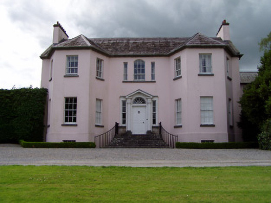 Ardsallagh Housefarmyard complex · 1003 yd
 Enclosure in Railstown (kilconnell Par.)Enclosure · 1588 yd
 Concentric enclosure in KilsallaghConcentric enclosure · 1673 yd
 Bawn in Ballyvadin (magorban Par.)Bawn · 1.2 mi
 Tullamain MoatCastle, motte and bailey · 1.3 mi
 Kilknockan HillMountain / peak · 3.5 mi
 European YewEuropean Yew · 3.5 mi
 Pedunculate OakPedunculate Oak · 4.6 mi
 Ballyknock HillMountain / peak · 5.2 mi
 Cashel Folk MusuemMuseum · 5.4 mi
 Athassel PrioryHeritage attraction · 9.0 mi