What is recorded here
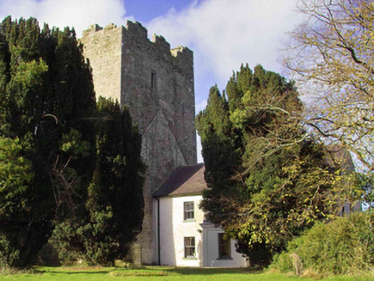
On a low hill there are a complex series of platforms, banks and ponds located to N of the medieval church of Clomantagh (KK013-003001-) and S and E of Clomantagh Castle, which is an early 16th-century tower house (KK013-002001-). A semicircular bank extends from NW-N-E of church forming a roughly circular area (max. diam. c. 60m) with the graveyard at the S. The SE portion of the interior is divided E-W and N-S by banks forming an enclosure (approx. dims. c. 45m²). It is likely that these earthworks are contemporary with the medieval church and tower house. These earthworks are visible on an aerial photograph (ASIAP (174) 18, 3 March 2001) and are also visible on DigitalGlobe satellite imagery (viewed 22 July 2019).
See attached photograph:
KK013-002005-_01 ASIAP (174) 18, 3 March 2001
KK013-002005-_02 Earthworks between church (KK013-003001-) and tower house (KK013-002001-) from tower house looking S
KK013-002005-_03 Earthworks between church (KK013-003001-) and tower house (KK013-002001-) from church looking N
KK013-002005-_04 Earthworks between church (KK013-003001-) and tower house (KK013-002001-) from church looking NW
Compiled by: Jean Farrelly
Date of upload: 22 July 2019
The monument record does not grant public access. Check the route and ask the landowner before entering private land.
- What survives
- Recorded monument
Places near here
 Sheela-na-gig in Clomantagh LowerSheela-na-gig · 64 yd
 CastleCastle, tower house · 69 yd
 Clomantagh Church (in ruins)Church · 83 yd
 farm housefarm house · 109 yd
 Fairy fort / earthen ringfort in Clomantagh LowerFairy fort / earthen ringfort · 330 yd
 Tubbrid Castle (in ruins)Castle, tower house · 1662 yd
 Clomantagh HillMountain / peak · 1.4 mi
 Kildrinagh WoodForest · 2.2 mi
 John HelyMemorial · 3.3 mi
 DelaneyMemorial · 3.4 mi
 Street fieldArchaeological place · 4.5 mi
 Anker's IslandIsland · 8.1 mi