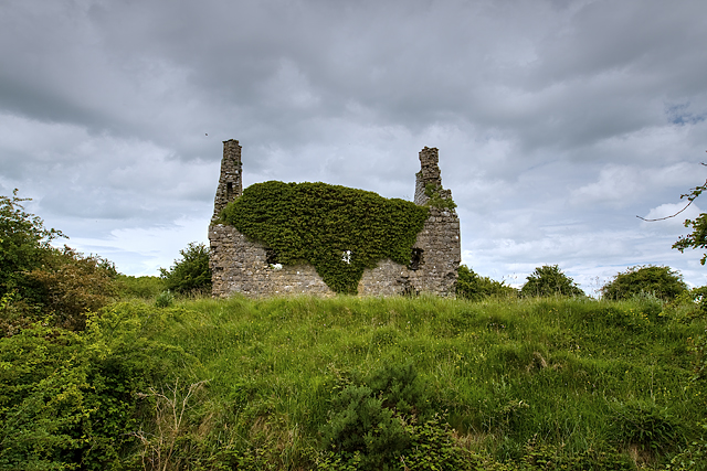
What is recorded here
Situated in pasture. Annotated 'Dundonnell Castle' and depicted on the 1837 ed. OS 6-inch map as a rectangular-shaped building with its long axis aligned NW-SE. A rectangular-shaped enclosure is shown running off S end of W wall of castle. On the 1837 map the castle appears to be standing in N corner of a rectangular-shaped enclosure which could represent the remains of a bawn (WM025-010001-). Castle described in 1978 as no surface remains visible. Earthworks clearly visible to the N of the castle appear to represent the remains of a field system. Linear earthwork to NE of castle and bawn probably represents the remains of a medieval roadway (WM025-010002-) leading into the castle and bawn. This sunken way defined by a two linear banks is clearly visible today on Digital Globe aerial photographs.
Compiled by Alison McQueen, Vera Rahilly and Caimin O’Brien
Date of upload: 03 September 2019
Dundonnell Castle was likely built by the Clan MacIntyre in the 16th or 17th century. It is remembered as a historic stronghold associated with the MacIntyre clan in the Lochaber area of Scotland.
The monument record does not grant public access. Check the route and ask the landowner before entering private land.
- What survives
- Recorded monument
Places near here
 IndicatedRoad, hollow-way · 293 yd
 Jamestown Househouse · 437 yd
 Ancient Ring FortWood · 1110 yd
 Tober FintanHoly well · 1549 yd
 Settlement desertedSettlement deserted, medieval · 1.0 mi
 Oldtown CastleCastle · 1.0 mi
 Fieldtown CastleCastle · 1.0 mi
 Hill of UisneachMountain / peak · 3.6 mi
 European ashEuropean ash · 4.5 mi
 Carrickphilbin IslandIslet · 5.3 mi
 Srudarra IslandIslet · 5.5 mi
 Abbeyshrule AbbeyRuins · 9.1 mi
Other information
Photo: Credit not shown in the picture search · Rights wording not checked; contact us if this picture should be removed