
What is recorded here
In gently SE-sloping pasture overlooking Lough Atedaun to the SE, and adjacent to a large ecclesiastical enclosure (CL017-119001-) which lies just to the W. Marked and labelled as ‘Cross’ on both the first (1842) and Cassini (1920) editions of the OS 6-inch map. This simple finial sandstone cross (H 0.43m; Wth 0.36m; T 0.1m) ‘ornamented with rude chisel work, and a good deal damaged’ (Macnamara 1900, 30) has a curving head and arms which narrow toward their ends (min. Wth 0.1m). The cross is set loosely at an angle in a vertical socket (L 36m; Wth 0.18m; D 0.17m) at the top of a rectangular sandstone base (H 0.74m; basal dims. L 0.57m; Wth 0.48m; top dims. L 0.59m; Wth 0.37m at base). The cross was not the object for which this base was intended and Macnamara (1900, 30) suggested that a cross shaft was originally set in the base. There is a worn lip (Wth 3.5cm; H 1cm) around the top edge of the socket and the rain-water which collected in the socket was widely believed to cure warts in both humans and animals (ibid.). Macnamara (ibid.) found the base set at the top of a ‘heap of stones faced by large, rough flags’. In 1999 the base was found oriented NE-SW (i.e., unlikely to be in its original position), standing in the centre of a square-shaped concrete platform (L 2.9m; Wth 2.7m) which was overshadowed by a whitethorn tree. Swan (1991, 63) suggested that this cross may have originally marked the approach to the entrance to the nearby ecclesiastical enclosure. In 1999, an architectural fragment (CL017-119005-), a window jambstone, was identified in the graveyard (CL017-119003-) c. 18m to the W of the cross; this architectural fragment was subsequently moved to beside the cross (Large 2011).
Compiled by: Gearóid Conroy and Conn Herriott
Date of upload: 16-10-2025
A high cross at Kilvoydan, likely erected between the 8th and 10th centuries, is associated with an adjacent ecclesiastical site and may be dedicated to a local saint; its survival offers insight into early Christian worship and artistic tradition in the region.
The monument record does not grant public access. Check the route and ask the landowner before entering private land.
- What survives
- Recorded monument
Places near here
 Killvoydan Church (in ruins)Church · 51 yd
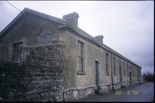 The Old Workhouseworkhouse · 617 yd
 Enclosure in KilvoydanEnclosure · 656 yd
 IndicatedEnclosure · 1043 yd
 Ballyporty Castle (in ruins) / TowerCastle, tower house · 1471 yd
 Rock IslandIsland · 1.4 mi
 Inchiquin IslandIslet · 1.5 mi
 Bawn in CregmoherBawn · 1.6 mi
 Battle of TullyodeaBattlefield · 1.8 mi
 Fergus River CaveCave · 3.4 mi
 Ballygriffy WoodWood · 3.4 mi
 Burren National ParkVisitor information · 3.5 mi
Other information
Photo: Credit not shown in the picture search · Rights wording not checked; contact us if this picture should be removed