What is recorded here
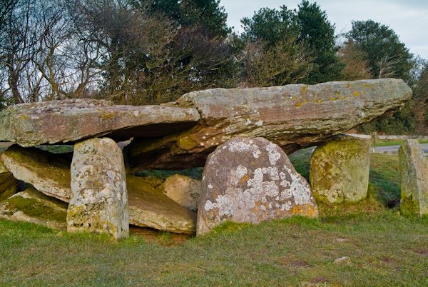
Situated in pasture on a broad plateau. Marked 'Cromlech' on the 1840 ed. of the OS 6-inch map and described by O'Donovan c. 1840 (O'Flanagan 1929, 32) as a long, flat stone supported on three uprights with another broken upright to one side. It may have survived until 1907 (Power 1906a, 252), but it has since disappeared without trace.
O'Flanagan, M. (Compiler) (1929) Letters containing information relative to the antiquities of the county of Waterford collected during the progress of the Ordnance Survey in 1841. Typescript. Bray.
Power, Rev. P. (1906a) The place-names of the Decies WAJ 9, 12-39, 80-106, 154-70, 228-65.
The above description is derived from the published 'Archaeological Inventory of County Waterford' (Dublin: Stationery Office, 1999). In certain instances the entries have been revised and updated in the light of recent research.
Date of upload/revision: 23 December 2008
The monument record does not grant public access. Check the route and ask the landowner before entering private land.
- What survives
- Recorded monument
Places near here
 Not idicatedFulacht fia · 677 yd
 CarrigfenoaghMountain / peak · 784 yd
 IndicatedFairy fort / earthen ringfort · 784 yd
 Fenoagh Church (in ruins)Church · 1284 yd
 Kilquan Church (in ruins)Church · 1751 yd
 CastleCastle, Anglo-Norman masonry castle · 1.5 mi
 Ormonde CastleHeritage attraction · 1.5 mi
 Tower HillMountain / peak · 1.8 mi
 Tower Hill WoodWood · 2.0 mi
 Tiberaghney CastleCastle, tower house · 2.0 mi
 Sitka SpruceSitka Spruce · 2.9 mi
 Portlaw Heritage CentreMuseum · 4.0 mi
Other information
Photo: Credit not shown in the picture search · Rights wording not checked; contact us if this picture should be removed