
What is recorded here
Clough Castle in County Down is an Anglo-Norman earthwork castle where a large mound still stands beside a small kidney-shaped bailey. Dudley Waterman excavated the summit in 1950 and found pits that may have belonged to archers, a timber palisade from the late 12th or early 13th century, and the foundation of a long rectangular hall. A two-storey stone keep survives to the south-west, later joined into an L-shaped tower-house after a period of disuse. The precise phases of use remain debated, but the mound and keep still mark the place where people stood guard, lived, left it empty, and returned to make it strong again.
Clough Castle is recorded as a castle in County Down. Its open map record supplies this location and any linked names or public references.
Clough Castle in County Down was built in the 17th century by the Stewart family, a prominent local Protestant landowning family. It is remembered as an example of early post-Tudor castle architecture in Ulster and reflects the period's patterns of land ownership and settlement.
Places near here
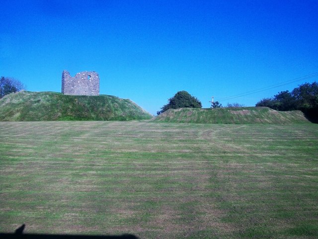 MOTTE & BAILEY AND TOWER-HOUSE: CLOUGH CASTLE in CloughMOTTE & BAILEY AND TOWER-HOUSE: CLOUGH CASTLE · 21 yd
 Clough Presbyterian ChurchChurch · 311 yd
 Clough Non-Subscribing Presbyterian ChurchChurch · 317 yd
 ENCLOSURE in ArdileaENCLOSURE · 1367 yd
 MOTTE in ArdileaMOTTE · 1495 yd
 Seaforde Woodland WalkWalking route · 1.3 mi
 Man-made underground passageCave · 1.5 mi
 Seaforde HouseCastle · 1.9 mi
 Castle PathWalking route · 2.1 mi
 Dundrum CastleHeritage attraction · 2.1 mi
 Mourne Coastal Route: Dundrum Main StreetVisitor information · 2.2 mi
 Dundrum Inner BayPicnic place · 3.1 mi
Other information
Photo: Man vyi · Public domain