What is recorded here
Cloghanlegaun is a leaning standing stone on a stripped ridge in County Galway, tilted forty degrees northward as if listening to something buried beneath the missing soil. Its rectangular body rises one and a half metres above the earth, flanked by small packing stones that suggest human hands once steadied it against the wind. The ridge has been scarred from both sides, yet the stone remains upright enough to mark a direction, a boundary, or a memory no longer spoken.
On a NNW-SSE ridge, the base of which has been stripped of topsoil from NE-WSW. This standing stone (H 1.35m; base Wth 1.15m; max. base T 0.3m) is aligned NE-SW and is roughly rectangular in plan. It leans at an angle of c. 40 degrees to the NW. Packing stones are visible at the base of its E face and there is another one at the base of its W face. Some topsoil has been dumped within 20m of it. (McCaffrey 1952, 212, no. 41)
Compiled by: Olive Alcock
Date of upload: 16 December 2019
The monument record does not grant public access. Check the route and ask the landowner before entering private land.
- What survives
- Recorded monument
Places near here
 Ballymanagh Ho.House, 18th/19th century · 354 yd
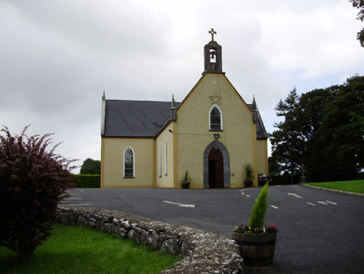 Saint Killian's Catholic Churchchurch/chapel · 382 yd
 Field system in BallynascraghField system · 542 yd
 Man-made underground passageMan-made underground passage · 554 yd
 CarnanthomasCastle, unclassified · 846 yd
 Cregg Castle (in ruins)Castle, tower house · 1.1 mi
 Moyard WoodWood · 4.2 mi
 Blake's IslandIslet · 5.0 mi
 Kilcornan ForestWood · 6.5 mi
 Drumacoo Monastic SiteHeritage attraction · 8.1 mi
 MweenisharanIslet · 9.6 mi
 Structure in BallynascraghStructure · 663 yd