What is recorded here
Cloghacorra is a ruined portal tomb in County Donegal, Ireland, where a two-metre upright stone still leans against a sidestone above boggy ground facing Malin Bay. Thomas Fagan saw the same broken chamber in 1847, proving that people had lived beside these stones for at least two centuries before modern records. The displaced slabs and hidden backstone suggest a three-metre chamber that once opened eastward, perhaps guiding the dead toward the valley light or giving the living a place to mark loss, birth and seasonal change.
This monument (National Monument no. 139 (4) in state care), 100m SE of the last (Dg. 93), stands in boggy ground on the northern slope of the valley opening onto Malin Bay. It commands a good outlook E and W along the valley, but rising ground restricts the view toward the N.
The structure is quite ruined and partly concealed by field stones heaped around it. An upright portal-stone and a sidestone represent the S side of an E-facing chamber, originally c. 3m long. To the S is a large prostrate slab. To the N is another large displaced slab, which leans against the top of the sidestone. This slab, which may have formed the N side of the structure, overlies and partly hides a smaller prostrate slab, possibly the backstone of the chamber. Approximately 2.5m N of the portal-stone is a low set stone. This is 0.75m long, 0.2m thick and 0.3m high. Its function is unclear.
The portal-stone, 2m high, narrows to the top. The sidestone is set outside this and leans against it. It is 1.1m high. The prostrate slab to the S, its southern edge grass grown, measures 2.7m by 1.8m and is 0.35m thick. This may have served as a roofstone. The displaced slab leaning against the N face of the sidestone is 2.7m in overall length, 0.3m thick at its northern end, which rests on the ground, and 0.1-0.15m thick at the southern end. If upright it would stand 1.6m high. The smaller slab beneath this is at least 0.9m in horizontal measurement and 0.3m thick.
Thomas Fagan (1845-8) saw this monument in 1847, and his account indicates that it was then in its present state. He also stated that there were the 'ruins of an enclosed grave' at the base of the nearby standing stone [DG089-006002-] but provided no details. This standing stone is 2.05m high (Lacy 1983, 84). There is a heap of field stones beside it now but no indication of any structure.
Fagan 1845-8, book 20, 11; N. Moore 1872, 524 ('The first of this group...'); Ferguson 1879, 121 (sketch); Anon. 1890-91a, 261 (fine cromlech used as a shelter for cattle); Borlase 1897, 240, 244, Banagh no. 2, and 249, Banagh nos. 9-20 (p. 240: 'In the same townland, on the opposite side of the road, are the remains of a dolmen, and near it a menhir'; p. 244: 'A monument was pointed out to me...'; p. 249: 'The first of this group is a chamber cromlech'); Killanin and Duignan 1967, 292; Ó Nualláin 1968a, 298, no. 17; Herity 1971, 28, no. 34; Ó Nualláin 1983a, 35, no. 68; Ó Nualláin 1983b, 95, Donegal no. 22; SMR 1987, 89:6; Ó Nualláin 1989, 124; Herity 1990, 50, no. 39; RMP 1995, 89:6.
The above description was published in the 'Survey of the Megalithic Tombs of Ireland. Volume VI, County Donegal.' Compiled by: Eamon Cody (Dublin: Stationery Office, 2002).
Date of upload: 22 September 2008
See linked document with details from Eamon Cody, Survey of the Megalithic Tombs of Ireland. Volume VI. County Donegal. (Dublin: Stationery Office, 2002)
Neolithic passage tomb; dates to approximately 3500–2500 BCE. Its location offers strategic views along the valley and bay, suggesting possible ritual or defensive significance in the Neolithic landscape.
The monument record does not grant public access. Check the route and ask the landowner before entering private land.
- What survives
- Recorded monument
Places near here
 Cloghacorra / Glenmalin Standing StoneStanding stone · 24 yd
 Chambered cairn, GlenmalinPublicly named cairn; age not proved by this picture · 124 yd
 An Trá Bheag (Trá Bheag an Ghleanna)Beach / strand · 1.0 mi
 Glencolmcille Folk VillageMuseum · 1.0 mi
 Trá an GhleannaBeach / strand · 1.3 mi
 Teach Pobail Naomh Columbachurch/chapel · 1.3 mi
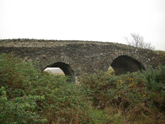 Droichead an tSráidbridge · 1.4 mi
 Glencolmcille Old GraveyardGraveyard · 1.6 mi
 Rossan PointHeadland · 2.1 mi
 Silver Strand ViewpointViewpoint · 2.3 mi
 Slieve LeagueMountain / peak · 3.3 mi
 Rathlin O'Birne IslandIslet · 3.7 mi