
What is recorded here
Marked 'Cloghacorra' on the 2nd and 3rd editions of the OS 6-inch maps, two stones (DG089-006002-; DG089-006003-) are shown. The site presently consists of one stone (DG089-006002-) 2.05m high, .76m N-S and 0.4m thick. 3m to the W is a cairn 15m NNE-SSW × 3m and 0.6m to .9m in height. The cairn is believed locally to be modern. The site is located in sloping poor 'pasture on the N side of Malin More valley 27.5m SSW of a portal tomb (dg089-006001-).
The above description was derived from the 'Archaeological Survey of County Donegal. A description of the field antiquities of the County from the Mesolithic Period to the 17th century.' Compiled by: Brian Lacey with Eamon Cody, Claire Cotter, Judy Cuppage, Noel Dunne, Vincent Hurley, Celie O'Rahilly, Paul Walsh and Seán Ó Nualláin (Lifford: Donegal County Council, 1983). In certain instances the entries have been revised and updated.
Likely dating to the Late Neolithic or Bronze Age, the Glenmalin standing stone may have functioned as a territorial marker, ceremonial focus, or astronomical alignment point. Local folklore sometimes associates such stones with legendary figures or supernatural events, though specific traditions for this site are not recorded.
The monument record does not grant public access. Check the route and ask the landowner before entering private land.
- What survives
- Recorded monument
Places near here
 Chambered cairn, GlenmalinPublicly named cairn; age not proved by this picture · 102 yd
 Málainn Mhóir Stone RingfortFairy fort / stone ringfort · 454 yd
 An Trá Bheag (Trá Bheag an Ghleanna)Beach / strand · 1.0 mi
 Glencolmcille Folk VillageMuseum · 1.0 mi
 Trá an GhleannaBeach / strand · 1.3 mi
 Teach Pobail Naomh Columbachurch/chapel · 1.3 mi
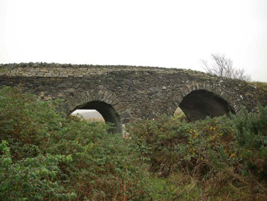 Droichead an tSráidbridge · 1.4 mi
 Glencolmcille Old GraveyardGraveyard · 1.6 mi
 Rossan PointHeadland · 2.1 mi
 Silver Strand ViewpointViewpoint · 2.3 mi
 Slieve LeagueMountain / peak · 3.3 mi
 Rathlin O'Birne IslandIslet · 3.7 mi
Other information
Photo: Kenneth Allen · CC BY-SA 2.0