What is recorded here
On NW bank of Awbeg River. Remains of foot bridge (L c. 35m; long axis NW-SE) survive, extending from E corner of Water House (14940). Bridge not marked on 1842 OS 6-inch map, river shown as being wider (Wth c. 35m) flowing along edge of Water House. According to local information, river dredged and narrowed (Wth c. 20m) in 1900s and SE section of bridge removed, leaving remainder on dry land - see photograph by Jones (1906, 200) and plan by O'Keeffe and Simington (1991, 309). Seven random-rubble limestone piers (H 0.7m-1m; Wth 0.96 to 1.37m ) remain; span increases from NW to SE. Piers bridged by long limestone slabs (L 1.1m to 2.5m). Thin strip of metal inserted into centre of three wider slabs. According to Grove White (1905-1925, vol. 4, 316), clapper bridge used by monks of Ballybeg Abbey (14379) which is located c. 450m to SE, to access grist mill somewhere in Waterhouse townland. May be associated with 'Monk's Pond' to rear of Springfield house (14849) on SE bank of river.
The above description is derived from the published 'Archaeological Inventory of County Cork. Volume 4: North Cork' (Dublin: Stationery Office, 2000). In certain instances the entries have been revised and updated in the light of recent research.
Date of upload/revision: 14 January 2009
The monument record does not grant public access. Check the route and ask the landowner before entering private land.
- What survives
- Recorded monument
Places near here
 Clapper Bridgefoot bridge · 24 yd
 Fish-pond in Ballybeg EastFish-pond · 30 yd
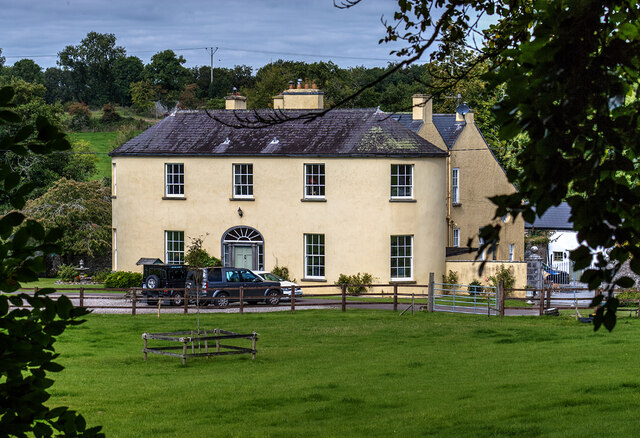 Springfieldcountry house · 101 yd
 Earthwork in Ballybeg EastEarthwork · 555 yd
 Charles BunworthMemorial · 810 yd
 Lombards CastleCastle, tower house · 1084 yd
 SycamoreSycamore · 1517 yd
 David HurleyMemorial · 1519 yd
 CastleCastle, unclassified · 1.5 mi
 Smith's WellSpring · 3.1 mi
 Doneraile HouseHeritage attraction · 3.4 mi
 European YewEuropean Yew · 3.5 mi