
What is recorded here
Situated on a gentle SW-facing slope within a circular graveyard (WA034-019004-) (diam. c. 60-65m) defined by a field bank NW-E-SW, and by a stone wall at the roadside SW-NW. The parish church of Kilcockan which was still in good repair at the end of the 16th century (Power 1898a, 213). Undifferentiated structure (ext. dims. 16.7m E-W; 8m N-S) surviving almost complete with quoins, except the W end which was incorporated into a mausoleum in 1830. The mausoleum occupies the church W of the original doorway in the S wall. There is a stoup and an aumbry in the S wall, ogee-headed lights with lintelled embrasures and dressed ingoings in the E and N walls, and a blocked window in the S wall.
The above description is derived from the published 'Archaeological Inventory of County Waterford' (Dublin: Stationery Office, 1999). In certain instances the entries have been revised and updated in the light of recent research.
Date of upload: 19 August 2010
The monument record does not grant public access. Check the route and ask the landowner before entering private land.
- What survives
- Recorded monument
Places near here
 Grave YardGraveyard · 22 yd
 Fulacht fia in CrosseryFulacht fia · 581 yd
 outbuildingoutbuilding · 1.0 mi
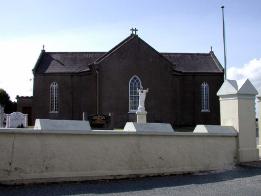 Catholic Church of the Sacred Heartchurch/chapel · 1.2 mi
 European ashEuropean ash · 2.6 mi
 Dromore WoodWood · 2.6 mi
 Molana AbbeyHeritage attraction · 2.7 mi
 Templemichael Castle (in ruins)Castle, tower house · 3.0 mi
 Clashmore Heritage CentreHeritage attraction · 3.3 mi
 CastleCastle, unclassified · 3.5 mi
 St Bridget's WellSpring · 3.6 mi
 Saint Declan's Holy WellSpring · 4.6 mi
Other information
Photo: Credit not shown in the picture search · Rights wording not checked; contact us if this picture should be removed