What is recorded here
Situated on a SE facing slope on lower slope of hill, river and marsh to SE, in pasture. Site depicted on 1st (1843) ed. OS 6-inch map as a large D-shaped enclosure (TN041-028), the site appears to have been somewhat modified to conform to the existing field pattern. In the interior of the enclosure there is a ruinous stone wall (W 1m crest, 2m base; int. H 0.62m; ext. H 0.5m) running 11.8m E-W with SW angle. There is a local tradition that this was a church (according to landowner). According to the landowner c.10 pieces of iron slag were found in interior of the site. The size of the site and local tradition suggest this could be an ecclesiastical enclosure.
Compiled by: Caimin O'Brien.
Date of upload: 22 September 2008
The monument record does not grant public access. Check the route and ask the landowner before entering private land.
- What survives
- Recorded monument
Places near here
 Ecclesiastical enclosure in GarrynamonaEcclesiastical enclosure · 1 yd
 Farney Bridgebridge · 900 yd
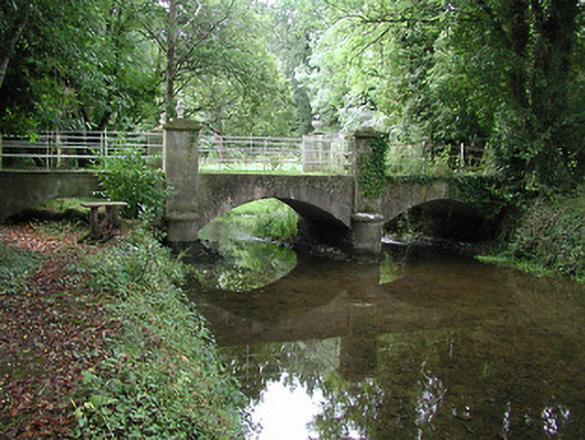 Farney Castlebridge · 999 yd
 Black Castle (in ruins)Castle, unclassified · 1288 yd
 BallycahillSettlement deserted, medieval · 1371 yd
 Ballynahow CastleCastle · 1.2 mi
 Cormackstown Heritage CentreMuseum · 1.5 mi
 Pallas HillMountain / peak · 2.8 mi
 KnockaneMountain / peak · 2.8 mi
 European ashEuropean ash · 3.3 mi
 Lár na PáirceMuseum · 3.5 mi
 Wildlife CorridorWood · 3.8 mi